Mianke Mor geodata
Mianke Mor (Punjab) is a populated place; located in Pakistan in Asia/Karachi (GMT+5) time zone. With population of 86,900 people, there are 77 cities with bigger population in this country. Compared to other cities in Pakistan, 55.8% of cities are located further ↓South; 88.9% of cities are located further ←West and 58.5% of cities have lower elevation than Mianke Mor. Note1


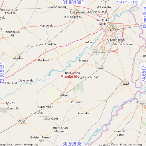
Mianke Mor GPS coordinates[2]
31° 12' 8.64" North, 73° 56' 54.852" East
| Map corner | latitude | longitude |
|---|---|---|
| Upper-left | 31.80189°, | 73.24545° |
| Center: | 31.2024°, | 73.94857° |
| Lower-right: | 30.59908°, | 74.6517° |
| Map W x H: | 133.7×133.7 km | = 83.1×83.1mi |
| max Lat: | 36.32162° ⇑44.2% North |
| Mianke Mor: | 31.2024° |
| min Lat: | ⇓55.8% South 24.14422° |
| min Long | Mianke Mor | max Long |
| 61.74573° | 73.94857° | 75.63372° |
| W 88.9%⇐ | ⇒11.1% E |
Elevation
Elevation of Mianke Mor is 200 m = 656 ft, and this is 145 m = 476 ft below average elevation for this country.
| Max E: |
2732 m = 8963 ft | 41.5% |
| Avg. | 345 m = 1132 ft | |
| Mianke Mor | 200 m = 656 ft | |
Min E: |
3 m = 10 ft | 58.5% |
See also: Mianke Mor elevation on elevation.city.
Geographical zone
Mianke Mor is located in North temperate zone (between Tropic of Cancer and the Arctic Circle). Distance of this Northern Tropic circle is 863.5 km =536.6 mi to South.| Distance of | km | miles | from Mianke Mor |
|---|---|---|---|
| North Pole | 6537.7 | 4062.3 | to North |
| Arctic Circle | 3931.8 | 2443.1 | to North |
| Tropic Cancer | 863.5 | 536.6 | to South |
| Equator | 3469.4 | 2155.8 | to South |


Nearby cities:
15 places around Mianke Mor: (largest is in red/bold)
• Chak Five Hundred Seventy-five
39.8 km =24.7 mi,  343°
343°
• Chunian
26.4 km =16.4 mi,  173°
173°
• Hujra Shah Muqim
52.6 km =32.7 mi,  193°
193°
• Jaranwala
52.4 km =32.6 mi,  286°
286°
• Kahna Nau
43.9 km =27.3 mi,  65°
65°
• Kanganpur
51.4 km =31.9 mi,  161°
161°
• Kasur
48.6 km =30.2 mi,  101°
101°
• Kot Radha Kishan
14.9 km =9.3 mi, 103°
• Mananwala
49.4 km =30.7 mi,  330°
330°
• Nankana Sahib
35.9 km =22.3 mi,  320°
320°
• Pattoki
22.2 km =13.8 mi,  204°
204°
• Raiwind
25.9 km =16.1 mi,  78°
78°
• Raja Jang
29.2 km =18.1 mi,  85°
85°
• Renala Khurd
49.1 km =30.5 mi,  222°
222°
• Sharqpur Sharif
32.2 km =20 mi,  26°
26°
Sources, notices
• [Note1] Compared only with cities in Pakistan existing in our database
• [Src1] Map data: © OpenStreetMap contributors (CC-BY-SA)
• [Src2] Other city data from geonames.org with taken over terms of usage.
• [Src3] Geographical zone / Annual Mean Temperature by Robert A. Rohde @ Wikipedia
