Gujar Khan geodata
Gujar Khan (Punjab) is a populated place; located in Pakistan in Asia/Karachi (GMT+5) time zone. With population of 69,374 people, there are 98 cities with bigger population in this country. Compared to other cities in Pakistan, 84.2% of cities are located further ↓South; 79% of cities are located further ←West and 81% of cities have lower elevation than Gujar Khan. Note1


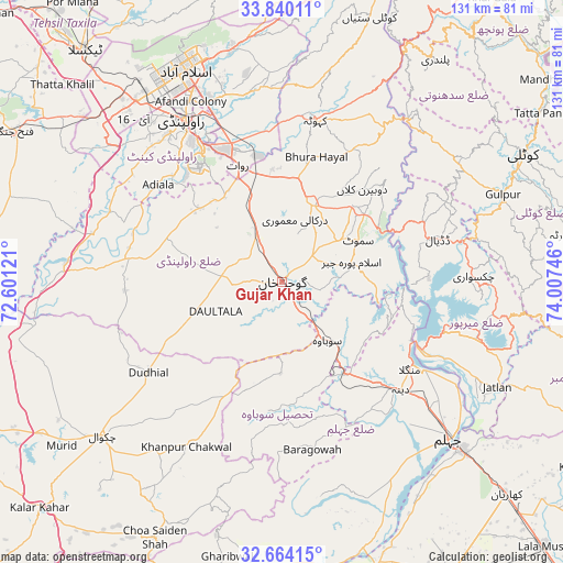
Gujar Khan GPS coordinates[2]
33° 15' 14.796" North, 73° 18' 15.588" East
| Map corner | latitude | longitude |
|---|---|---|
| Upper-left | 33.84011°, | 72.60121° |
| Center: | 33.25411°, | 73.30433° |
| Lower-right: | 32.66415°, | 74.00746° |
| Map W x H: | 130.8×130.8 km | = 81.3×81.3mi |
| max Lat: | 36.32162° ⇑15.8% North |
| Gujar Khan: | 33.25411° |
| min Lat: | ⇓84.2% South 24.14422° |
| min Long | Gujar Khan | max Long |
| 61.74573° | 73.30433° | 75.63372° |
| W 79%⇐ | ⇒21% E |
Elevation
Elevation of Gujar Khan is 461 m = 1512 ft, and this is 116 m = 381 ft above average elevation for this country.
| Max E: |
2732 m = 8963 ft | 19% |
| Gujar Khan | 461 m 1512 ft | |
| Avg. | 345 m = 1132 ft | |
Min E: |
3 m = 10 ft | 81% |
See also: Gujar Khan elevation on elevation.city.
Geographical zone
Gujar Khan is located in North temperate zone (between Tropic of Cancer and the Arctic Circle). Distance of this Northern Tropic circle is 1091.6 km =678.3 mi to South.| Distance of | km | miles | from Gujar Khan |
|---|---|---|---|
| North Pole | 6309.6 | 3920.6 | to North |
| Arctic Circle | 3703.7 | 2301.4 | to North |
| Tropic Cancer | 1091.6 | 678.3 | to South |
| Equator | 3697.5 | 2297.5 | to South |


Nearby cities:
15 places around Gujar Khan: (largest is in red/bold)
• Chakwal
55.1 km =34.2 mi,  229°
229°
• Choa Saidan Shah
66.4 km =41.3 mi,  206°
206°
• Daultala
16.7 km =10.4 mi,  245°
245°
• Islamabad
57.3 km =35.6 mi,  335°
335°
• Jhelum
53.3 km =33.1 mi,  131°
131°
• Kahuta
38.3 km =23.8 mi,  11°
11°
• Kamra
58.1 km =36.1 mi,  19°
19°
• Kharian
72.9 km =45.3 mi, 131°
• Khewra
72.6 km =45.1 mi,  202°
202°
• Kotli
62.8 km =39 mi,  62°
62°
• Mehmand Chak
71.1 km =44.2 mi,  137°
137°
• Nazir Town
17.6 km =10.9 mi,  70°
70°
• New Mirpur
43.3 km =26.9 mi,  105°
105°
• Rawalpindi
45 km =28 mi,  328°
328°
• Sarai Alamgir
57.2 km =35.5 mi, 132°
Sources, notices
• [Note1] Compared only with cities in Pakistan existing in our database
• [Src1] Map data: © OpenStreetMap contributors (CC-BY-SA)
• [Src2] Other city data from geonames.org with taken over terms of usage.
• [Src3] Geographical zone / Annual Mean Temperature by Robert A. Rohde @ Wikipedia
