Sarai Alamgir geodata
Sarai Alamgir (Punjab) is a populated place; located in Pakistan in Asia/Karachi (GMT+5) time zone. With population of 44,120 people, there are 146 cities with bigger population in this country. Compared to other cities in Pakistan, 81.5% of cities are located further ↓South; 85.6% of cities are located further ←West and 67.7% of cities have lower elevation than Sarai Alamgir. Note1


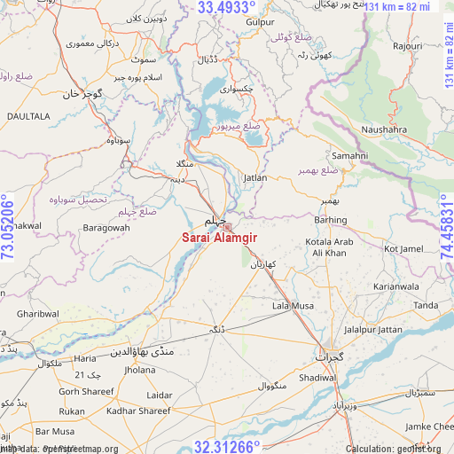
Sarai Alamgir GPS coordinates[2]
32° 54' 17.82" North, 73° 45' 18.648" East
| Map corner | latitude | longitude |
|---|---|---|
| Upper-left | 33.4933°, | 73.05206° |
| Center: | 32.90495°, | 73.75518° |
| Lower-right: | 32.31266°, | 74.45831° |
| Map W x H: | 131.3×131.3 km | = 81.6×81.6mi |
| max Lat: | 36.32162° ⇑18.5% North |
| Sarai Alamgir: | 32.90495° |
| min Lat: | ⇓81.5% South 24.14422° |
| min Long | Sarai Alamgir | max Long |
| 61.74573° | 73.75518° | 75.63372° |
| W 85.6%⇐ | ⇒14.4% E |
Elevation
Elevation of Sarai Alamgir is 232 m = 761 ft, and this is 113 m = 371 ft below average elevation for this country.
| Max E: |
2732 m = 8963 ft | 32.3% |
| Avg. | 345 m = 1132 ft | |
| Sarai Alamgir | 232 m = 761 ft | |
Min E: |
3 m = 10 ft | 67.7% |
See also: Sarai Alamgir elevation on elevation.city.
Geographical zone
Sarai Alamgir is located in North temperate zone (between Tropic of Cancer and the Arctic Circle). Distance of this Northern Tropic circle is 1052.8 km =654.2 mi to South.| Distance of | km | miles | from Sarai Alamgir |
|---|---|---|---|
| North Pole | 6348.4 | 3944.7 | to North |
| Arctic Circle | 3742.5 | 2325.5 | to North |
| Tropic Cancer | 1052.8 | 654.2 | to South |
| Equator | 3658.7 | 2273.4 | to South |


Nearby cities:
15 places around Sarai Alamgir: (largest is in red/bold)
• Bhimbar
31.1 km =19.3 mi,  75°
75°
• Dinga
29.5 km =18.3 mi,  186°
186°
• Gujar Khan
57.2 km =35.5 mi,  312°
312°
• Gujrat
47.4 km =29.5 mi,  140°
140°
• Jalalpur Jattan
51.3 km =31.9 mi,  124°
124°
• Jhelum
4 km =2.5 mi,  325°
325°
• Kharian
15.8 km =9.8 mi,  128°
128°
• Kunjah
46.5 km =28.9 mi,  153°
153°
• Lala Musa
29.5 km =18.3 mi, 140°
• Mandi Bahauddin
43.1 km =26.8 mi,  214°
214°
• Mehmand Chak
14.7 km =9.1 mi, 154°
• Nazir Town
51.3 km =31.9 mi, 330°
• New Mirpur
27 km =16.8 mi,  359°
359°
• Phalia
55.2 km =34.3 mi,  197°
197°
• Wazirabad
61.7 km =38.3 mi, 146°
Sources, notices
• [Note1] Compared only with cities in Pakistan existing in our database
• [Src1] Map data: © OpenStreetMap contributors (CC-BY-SA)
• [Src2] Other city data from geonames.org with taken over terms of usage.
• [Src3] Geographical zone / Annual Mean Temperature by Robert A. Rohde @ Wikipedia
