Arifwala geodata
Arifwala (Punjab) is a populated place; located in Pakistan in Asia/Karachi (GMT+5) time zone. With population of 87,360 people, there are 76 cities with bigger population in this country. Compared to other cities in Pakistan, 56.4% of cities are located further ↑North; 74.5% of cities are located further ←West and 57.1% of cities have higher elevation than Arifwala. Note1


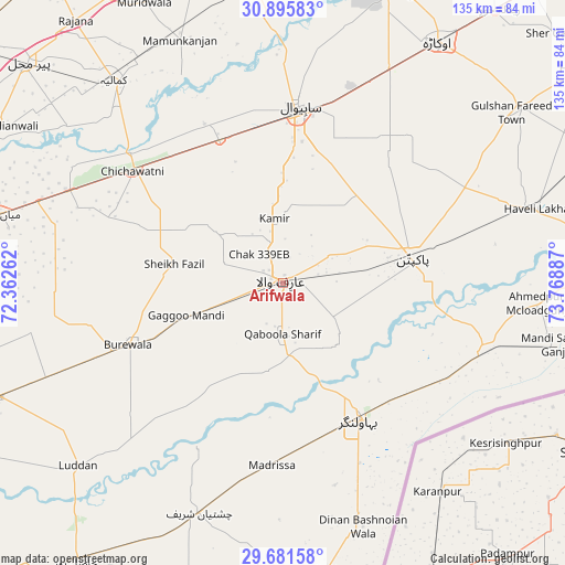
Arifwala GPS coordinates[2]
30° 17' 26.088" North, 73° 3' 56.664" East
| Map corner | latitude | longitude |
|---|---|---|
| Upper-left | 30.89583°, | 72.36262° |
| Center: | 30.29058°, | 73.06574° |
| Lower-right: | 29.68158°, | 73.76887° |
| Map W x H: | 135×135 km | = 83.9×83.9mi |
| max Lat: | 36.32162° ⇑56.4% North |
| Arifwala: | 30.29058° |
| min Lat: | ⇓43.6% South 24.14422° |
| min Long | Arifwala | max Long |
| 61.74573° | 73.06574° | 75.63372° |
| W 74.5%⇐ | ⇒25.5% E |
Elevation
Elevation of Arifwala is 159 m = 522 ft, and this is 186 m = 610 ft below average elevation for this country.
| Max E: |
2732 m = 8963 ft | 57.1% |
| Avg. | 345 m = 1132 ft | |
| Arifwala | 159 m = 522 ft | |
Min E: |
3 m = 10 ft | 42.9% |
See also: Arifwala elevation on elevation.city.
Geographical zone
Arifwala is located in North temperate zone (between Tropic of Cancer and the Arctic Circle). Distance of this Northern Tropic circle is 762.1 km =473.5 mi to South.| Distance of | km | miles | from Arifwala |
|---|---|---|---|
| North Pole | 6639.1 | 4125.3 | to North |
| Arctic Circle | 4033.2 | 2506.1 | to North |
| Tropic Cancer | 762.1 | 473.5 | to South |
| Equator | 3368 | 2092.8 | to South |


Nearby cities:
15 places around Arifwala: (largest is in red/bold)
• Bahawalnagar
37.1 km =23.1 mi,  151°
151°
• Bahawalnagar
42.5 km =26.4 mi,  47°
47°
• Būrewāla
42.2 km =26.2 mi,  250°
250°
• Chak Azam Sahu
51.4 km =31.9 mi,  356°
356°
• Chak One Hundred Twenty Nine Left
15.5 km =9.6 mi,  352°
352°
• Chak Thirty-one -Eleven Left
38.3 km =23.8 mi,  292°
292°
• Chichawatni
44.7 km =27.8 mi,  306°
306°
• Chishtian
58.4 km =36.3 mi,  200°
200°
• Dinan Bashnoian Wala
61.4 km =38.2 mi,  161°
161°
• Dunga Bunga
62.5 km =38.8 mi, 164°
• Haveli Lakha
62.8 km =39 mi,  73°
73°
• Kamalia
63 km =39.1 mi,  320°
320°
• Minchianabad
50.3 km =31.3 mi,  106°
106°
• Pakpattan
31.6 km =19.6 mi,  79°
79°
• Sahiwal
41.9 km =26 mi,  4°
4°
Sources, notices
• [Note1] Compared only with cities in Pakistan existing in our database
• [Src1] Map data: © OpenStreetMap contributors (CC-BY-SA)
• [Src2] Other city data from geonames.org with taken over terms of usage.
• [Src3] Geographical zone / Annual Mean Temperature by Robert A. Rohde @ Wikipedia
