Haveli Lakha geodata
Haveli Lakha (Punjab) is a populated place; located in Pakistan in Asia/Karachi (GMT+5) time zone. With population of 65,289 people, there are 108 cities with bigger population in this country. Compared to other cities in Pakistan, 54.2% of cities are located further ↑North; 84.2% of cities are located further ←West and 51.5% of cities have higher elevation than Haveli Lakha. Note1


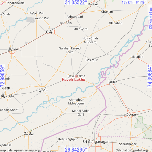
Haveli Lakha GPS coordinates[2]
30° 27' 3.492" North, 73° 41' 37.356" East
| Map corner | latitude | longitude |
|---|---|---|
| Upper-left | 31.05522°, | 72.99059° |
| Center: | 30.45097°, | 73.69371° |
| Lower-right: | 29.84295°, | 74.39684° |
| Map W x H: | 134.8×134.8 km | = 83.8×83.8mi |
| max Lat: | 36.32162° ⇑54.2% North |
| Haveli Lakha: | 30.45097° |
| min Lat: | ⇓45.8% South 24.14422° |
| min Long | Haveli Lakha | max Long |
| 61.74573° | 73.69371° | 75.63372° |
| W 84.2%⇐ | ⇒15.8% E |
Elevation
Elevation of Haveli Lakha is 175 m = 574 ft, and this is 170 m = 558 ft below average elevation for this country.
| Max E: |
2732 m = 8963 ft | 51.5% |
| Avg. | 345 m = 1132 ft | |
| Haveli Lakha | 175 m = 574 ft | |
Min E: |
3 m = 10 ft | 48.5% |
See also: Haveli Lakha elevation on elevation.city.
Geographical zone
Haveli Lakha is located in North temperate zone (between Tropic of Cancer and the Arctic Circle). Distance of this Northern Tropic circle is 779.9 km =484.6 mi to South.| Distance of | km | miles | from Haveli Lakha |
|---|---|---|---|
| North Pole | 6621.2 | 4114.2 | to North |
| Arctic Circle | 4015.3 | 2495 | to North |
| Tropic Cancer | 779.9 | 484.6 | to South |
| Equator | 3385.8 | 2103.8 | to South |


Nearby cities:
15 places around Haveli Lakha: (largest is in red/bold)
• Arifwala
62.8 km =39 mi,  253°
253°
• Bahawalnagar
31.1 km =19.3 mi,  290°
290°
• Basirpur
19.8 km =12.3 mi,  44°
44°
• Chak One Hundred Twenty Nine Left
62.2 km =38.6 mi,  267°
267°
• Chunian
63.5 km =39.5 mi,  25°
25°
• Dipalpur
24.6 km =15.3 mi,  350°
350°
• Hujra Shah Muqim
34.6 km =21.5 mi,  20°
20°
• Kanganpur
53.9 km =33.5 mi,  49°
49°
• Minchianabad
34.1 km =21.2 mi,  200°
200°
• Mustafābād
52.5 km =32.6 mi,  339°
339°
• Okara
46.2 km =28.7 mi,  329°
329°
• Pakpattan
31.5 km =19.6 mi, 247°
• Pattoki
65.1 km =40.5 mi,  13°
13°
• Renala Khurd
48.4 km =30.1 mi, 349°
• Sahiwal
61.5 km =38.2 mi, 292°
Sources, notices
• [Note1] Compared only with cities in Pakistan existing in our database
• [Src1] Map data: © OpenStreetMap contributors (CC-BY-SA)
• [Src2] Other city data from geonames.org with taken over terms of usage.
• [Src3] Geographical zone / Annual Mean Temperature by Robert A. Rohde @ Wikipedia
