Gakuch geodata
Gakuch (Gilgit-Baltistan) is a seat of a second-order administrative division; located in Pakistan in Asia/Karachi (GMT+5) time zone. In our database, there are 416 cities with bigger population. Compared to other cities in Pakistan, 99.5% of cities are located further ↓South; 86% of cities are located further ←West and 97.5% of cities have lower elevation than Gakuch. Note1


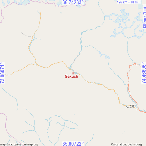
Gakuch GPS coordinates[2]
36° 10' 36.588" North, 73° 45' 49.788" East
| Map corner | latitude | longitude |
|---|---|---|
| Upper-left | 36.74233°, | 73.06071° |
| Center: | 36.17683°, | 73.76383° |
| Lower-right: | 35.60722°, | 74.46696° |
| Map W x H: | 126.2×126.2 km | = 78.4×78.4mi |
| max Lat: | 36.32162° ⇑0.5% North |
| Gakuch: | 36.17683° |
| min Lat: | ⇓99.5% South 24.14422° |
| min Long | Gakuch | max Long |
| 61.74573° | 73.76383° | 75.63372° |
| W 86%⇐ | ⇒14% E |
Elevation
Elevation of Gakuch is 1892 m = 6207 ft, and this is 1547 m = 5075 ft above average elevation for this country.
| Max E: |
2732 m = 8963 ft | 2.5% |
| Gakuch | 1892 m 6207 ft | |
| Avg. | 345 m = 1132 ft | |
Min E: |
3 m = 10 ft | 97.5% |
See also: Pakistan elevation on elevation.city.
Geographical zone
Gakuch is located in North temperate zone (between Tropic of Cancer and the Arctic Circle). Distance of this Northern Tropic circle is 1416.6 km =880.2 mi to South.| Distance of | km | miles | from Gakuch |
|---|---|---|---|
| North Pole | 5984.6 | 3718.7 | to North |
| Arctic Circle | 3378.7 | 2099.4 | to North |
| Tropic Cancer | 1416.6 | 880.2 | to South |
| Equator | 4022.5 | 2499.5 | to South |


Nearby cities:
15 places around Gakuch: (largest is in red/bold)
• Aliabad
77.7 km =48.3 mi,  79°
79°
• Alpurai
173.2 km =107.6 mi,  216°
216°
• Athmuqam
178.9 km =111.2 mi,  176°
176°
• Baffa
199.5 km =124 mi,  194°
194°
• Barishal
85 km =52.8 mi, 79°
• Battagram
179.7 km =111.7 mi,  201°
201°
• Chilas
90.3 km =56.1 mi,  160°
160°
• Chitral
181.5 km =112.8 mi,  258°
258°
• Dasu
107.3 km =66.7 mi, 203°
• Eidgah
135 km =83.9 mi,  133°
133°
• Gilgit
57.1 km =35.5 mi,  120°
120°
• Mingora
200.6 km =124.6 mi, 219°
• Shingli Bala
180.9 km =112.4 mi, 202°
• Skardu
195 km =121.2 mi, 120°
• Thal
157.5 km =97.9 mi,  240°
240°
Sources, notices
• [Note1] Compared only with cities in Pakistan existing in our database
• [Src1] Map data: © OpenStreetMap contributors (CC-BY-SA)
• [Src2] Other city data from geonames.org with taken over terms of usage.
• [Src3] Geographical zone / Annual Mean Temperature by Robert A. Rohde @ Wikipedia
