Skardu geodata
Skardu (Gilgit-Baltistan) is a populated place; located in Pakistan in Asia/Karachi (GMT+5) time zone. With population of 2,100 people, there are 397 cities with bigger population in this country. Compared to other cities in Pakistan, 98.2% of cities are located further ↓South; 100% of cities are located further ←West and 99.1% of cities have lower elevation than Skardu. Note1


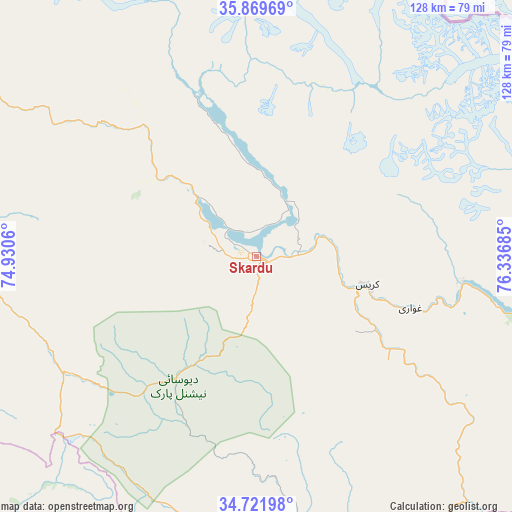
Skardu GPS coordinates[2]
35° 17' 52.332" North, 75° 38' 1.392" East
| Map corner | latitude | longitude |
|---|---|---|
| Upper-left | 35.86969°, | 74.9306° |
| Center: | 35.29787°, | 75.63372° |
| Lower-right: | 34.72198°, | 76.33685° |
| Map W x H: | 127.6×127.6 km | = 79.3×79.3mi |
| max Lat: | 36.32162° ⇑1.8% North |
| Skardu: | 35.29787° |
| min Lat: | ⇓98.2% South 24.14422° |
| min Long | Skardu | max Long |
| 61.74573° | 75.63372° | 75.63372° |
| W 100%⇐ | ⇒0% E |
Elevation
Elevation of Skardu is 2241 m = 7352 ft, and this is 1896 m = 6220 ft above average elevation for this country.
| Max E: |
2732 m = 8963 ft | 0.90000000000001% |
| Skardu | 2241 m 7352 ft | |
| Avg. | 345 m = 1132 ft | |
Min E: |
3 m = 10 ft | 99.1% |
See also: Pakistan elevation on elevation.city.
Geographical zone
Skardu is located in North temperate zone (between Tropic of Cancer and the Arctic Circle). Distance of this Northern Tropic circle is 1318.8 km =819.5 mi to South.| Distance of | km | miles | from Skardu |
|---|---|---|---|
| North Pole | 6082.3 | 3779.4 | to North |
| Arctic Circle | 3476.4 | 2160.1 | to North |
| Tropic Cancer | 1318.8 | 819.5 | to South |
| Equator | 3924.8 | 2438.8 | to South |


Nearby cities:
15 places around Skardu: (largest is in red/bold)
• Aliabad
145 km =90.1 mi,  320°
320°
• Athmuqam
177.7 km =110.4 mi,  242°
242°
• Baffa
239.8 km =149 mi,  246°
246°
• Bagh
224.3 km =139.4 mi,  229°
229°
• Barishal
141.8 km =88.1 mi, 323°
• Battagram
247.6 km =153.9 mi, 253°
• Chilas
139.3 km =86.6 mi,  275°
275°
• Dasu
212.6 km =132.1 mi,  269°
269°
• Eidgah
70.7 km =43.9 mi, 274°
• Gakuch
195 km =121.2 mi,  300°
300°
• Gilgit
138 km =85.7 mi, 300°
• Hattian Bala
213.5 km =132.7 mi, 233°
• Mansehra
247.1 km =153.5 mi, 244°
• Muzaffarābād
222.7 km =138.4 mi, 242°
• Rawala Kot
234.6 km =145.8 mi, 226°
Sources, notices
• [Note1] Compared only with cities in Pakistan existing in our database
• [Src1] Map data: © OpenStreetMap contributors (CC-BY-SA)
• [Src2] Other city data from geonames.org with taken over terms of usage.
• [Src3] Geographical zone / Annual Mean Temperature by Robert A. Rohde @ Wikipedia
