Eidgah geodata
Eidgah (Gilgit-Baltistan) is a seat of a second-order administrative division; located in Pakistan in Asia/Karachi (GMT+5) time zone. In our database, there are 416 cities with bigger population. Compared to other cities in Pakistan, 98.4% of cities are located further ↓South; 98.9% of cities are located further ←West and 99.3% of cities have lower elevation than Eidgah. Note1


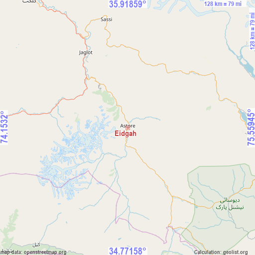
Eidgah GPS coordinates[2]
35° 20' 49.632" North, 74° 51' 22.752" East
| Map corner | latitude | longitude |
|---|---|---|
| Upper-left | 35.91859°, | 74.1532° |
| Center: | 35.34712°, | 74.85632° |
| Lower-right: | 34.77158°, | 75.55945° |
| Map W x H: | 127.5×127.5 km | = 79.2×79.2mi |
| max Lat: | 36.32162° ⇑1.6% North |
| Eidgah: | 35.34712° |
| min Lat: | ⇓98.4% South 24.14422° |
| min Long | Eidgah | max Long |
| 61.74573° | 74.85632° | 75.63372° |
| W 98.9%⇐ | ⇒1.1% E |
Elevation
Elevation of Eidgah is 2372 m = 7782 ft, and this is 2027 m = 6650 ft above average elevation for this country.
| Max E: |
2732 m = 8963 ft | 0.7% |
| Eidgah | 2372 m 7782 ft | |
| Avg. | 345 m = 1132 ft | |
Min E: |
3 m = 10 ft | 99.3% |
See also: Pakistan elevation on elevation.city.
Geographical zone
Eidgah is located in North temperate zone (between Tropic of Cancer and the Arctic Circle). Distance of this Northern Tropic circle is 1324.3 km =822.9 mi to South.| Distance of | km | miles | from Eidgah |
|---|---|---|---|
| North Pole | 6076.8 | 3775.9 | to North |
| Arctic Circle | 3470.9 | 2156.7 | to North |
| Tropic Cancer | 1324.3 | 822.9 | to South |
| Equator | 3930.2 | 2442.1 | to South |


Nearby cities:
15 places around Eidgah: (largest is in red/bold)
• Aliabad
108.9 km =67.7 mi,  348°
348°
• Athmuqam
122.8 km =76.3 mi,  225°
225°
• Baffa
180 km =111.8 mi,  235°
235°
• Bagh
181.2 km =112.6 mi,  213°
213°
• Barishal
109.3 km =67.9 mi, 352°
• Battagram
182.8 km =113.6 mi,  245°
245°
• Chilas
68.6 km =42.6 mi,  276°
276°
• Dasu
142.2 km =88.4 mi,  267°
267°
• Gakuch
135 km =83.9 mi,  313°
313°
• Gilgit
80.3 km =49.9 mi,  322°
322°
• Hattian Bala
165.8 km =103 mi,  217°
217°
• Mansehra
189 km =117.4 mi, 233°
• Muzaffarābād
166.7 km =103.6 mi, 229°
• Shingli Bala
185.9 km =115.5 mi, 246°
• Skardu
70.7 km =43.9 mi,  94°
94°
Sources, notices
• [Note1] Compared only with cities in Pakistan existing in our database
• [Src1] Map data: © OpenStreetMap contributors (CC-BY-SA)
• [Src2] Other city data from geonames.org with taken over terms of usage.
• [Src3] Geographical zone / Annual Mean Temperature by Robert A. Rohde @ Wikipedia
