Wojsławice geodata
Wojsławice (Łódź Voivodeship) is a populated place; located in Poland in Europe/Warsaw (GMT+2) time zone. With population of 610 people, there are 3248 cities with bigger population in this country. Compared to other cities in Poland, 59.2% of cities are located further ↓South; 61.4% of cities are located further →East and 50.8% of cities have lower elevation than Wojsławice. Note1
Administrative division(s):
- Level 1: Łódź Voivodeship
- Level 2: Powiat zduńskowolski
- Level 3: Zduńska Wola


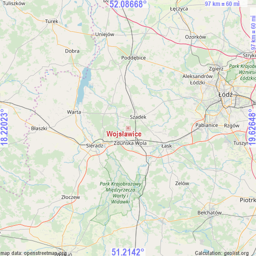
Wojsławice GPS coordinates[2]
51° 39' 9.144" North, 18° 55' 24.06" East
| Map corner | latitude | longitude |
|---|---|---|
| Upper-left | 52.08668°, | 18.22023° |
| Center: | 51.65254°, | 18.92335° |
| Lower-right: | 51.2142°, | 19.62648° |
| Map W x H: | 97×97 km | = 60.3×60.3mi |
| max Lat: | 54.83135° ⇑40.8% North |
| Wojsławice: | 51.65254° |
| min Lat: | ⇓59.2% South 49.21328° |
| min Long | Wojsławice | max Long |
| 14.20249° | 18.92335° | 24.03723° |
| W 38.6%⇐ | ⇒61.4% E |
Elevation
Elevation of Wojsławice is 174 m = 571 ft, and this is 17.4 m = 57 ft below average elevation for this country.
| Max E: |
974 m = 3196 ft | 49.2% |
| Avg. | 191.4 m = 628 ft | |
| Wojsławice | 174 m = 571 ft | |
Min E: |
-3 m = -10 ft | 50.8% |
See also: Poland elevation on elevation.city.
Geographical zone
Wojsławice is located in North temperate zone (between Tropic of Cancer and the Arctic Circle). Distance of this North polar circle is 1658 km =1030.2 mi to North.| Distance of | km | miles | from Wojsławice |
|---|---|---|---|
| North Pole | 4263.8 | 2649.4 | to North |
| Arctic Circle | 1658 | 1030.2 | to North |
| Tropic Cancer | 3137.3 | 1949.4 | to South |
| Equator | 5743.2 | 3568.7 | to South |


Nearby cities:
15 places around Wojsławice: (largest is in red/bold)
• Burzenin
22.2 km =13.8 mi,  196°
196°
• Dobroń
22.3 km =13.9 mi,  93°
93°
• Kazimierz
23.4 km =14.5 mi,  56°
56°
• Lutomiersk
22.8 km =14.2 mi, 60°
• Pęczniew
21.8 km =13.5 mi,  320°
320°
• Sieradz
14.7 km =9.1 mi,  244°
244°
• Szadek
5.7 km =3.5 mi,  39°
39°
• Sędziejowice
17.7 km =11 mi,  156°
156°
• Warta
21.6 km =13.4 mi,  287°
287°
• Wodzierady
17.3 km =10.7 mi,  65°
65°
• Wróblew
21.8 km =13.5 mi,  258°
258°
• Zadzim
14.7 km =9.1 mi,  339°
339°
• Zapolice
12.5 km =7.8 mi,  192°
192°
• Zduńska Wola
6 km =3.7 mi,  169°
169°
• Łask
16 km =9.9 mi,  115°
115°
Sources, notices
• [Note1] Compared only with cities in Poland existing in our database
• [Src1] Map data: © OpenStreetMap contributors (CC-BY-SA)
• [Src2] Other city data from geonames.org with taken over terms of usage.
• [Src3] Geographical zone / Annual Mean Temperature by Robert A. Rohde @ Wikipedia
