Tułowice geodata
Tułowice (Opole Voivodeship) is a populated place; located in Poland in Europe/Warsaw (GMT+2) time zone. With population of 4,290 people, there are 765 cities with bigger population in this country. Compared to other cities in Poland, 65.2% of cities are located further ↑North; 78.8% of cities are located further →East and 50.8% of cities have lower elevation than Tułowice. Note1


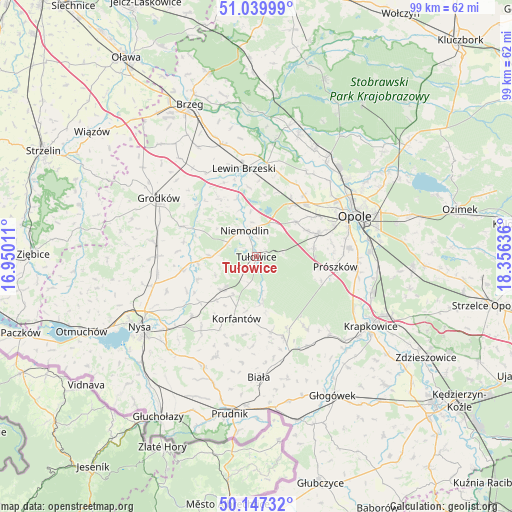
Tułowice GPS coordinates[2]
50° 35' 44.772" North, 17° 39' 11.628" East
| Map corner | latitude | longitude |
|---|---|---|
| Upper-left | 51.03999°, | 16.95011° |
| Center: | 50.59577°, | 17.65323° |
| Lower-right: | 50.14732°, | 18.35636° |
| Map W x H: | 99.3×99.3 km | = 61.7×61.7mi |
| max Lat: | 54.83135° ⇑65.2% North |
| Tułowice: | 50.59577° |
| min Lat: | ⇓34.8% South 49.21328° |
| min Long | Tułowice | max Long |
| 14.20249° | 17.65323° | 24.03723° |
| W 21.2%⇐ | ⇒78.8% E |
Elevation
Elevation of Tułowice is 174 m = 571 ft, and this is 17.4 m = 57 ft below average elevation for this country.
| Max E: |
974 m = 3196 ft | 49.2% |
| Avg. | 191.4 m = 628 ft | |
| Tułowice | 174 m = 571 ft | |
Min E: |
-3 m = -10 ft | 50.8% |
See also: Poland elevation on elevation.city.
Geographical zone
Tułowice is located in North temperate zone (between Tropic of Cancer and the Arctic Circle). Distance of this North polar circle is 1775.5 km =1103.2 mi to North.| Distance of | km | miles | from Tułowice |
|---|---|---|---|
| North Pole | 4381.3 | 2722.4 | to North |
| Arctic Circle | 1775.5 | 1103.2 | to North |
| Tropic Cancer | 3019.8 | 1876.4 | to South |
| Equator | 5625.7 | 3495.6 | to South |


Nearby cities:
15 places around Tułowice: (largest is in red/bold)
• Borkowice
16.7 km =10.4 mi,  15°
15°
• Chmielowice
16.2 km =10.1 mi,  68°
68°
• Chrościna
14 km =8.7 mi,  56°
56°
• Dąbrowa
11.9 km =7.4 mi,  34°
34°
• Jasienica Dolna
13.9 km =8.6 mi,  231°
231°
• Karczów
15.1 km =9.4 mi,  37°
37°
• Komprachcice
13 km =8.1 mi, 69°
• Korfantów
12.5 km =7.8 mi,  197°
197°
• Lewin Brzeski
17.2 km =10.7 mi,  351°
351°
• Niemodlin
5.7 km =3.5 mi,  335°
335°
• Prusinowice
18.6 km =11.6 mi,  249°
249°
• Prószków
15.5 km =9.6 mi,  97°
97°
• Sidzina
14.6 km =9.1 mi,  260°
260°
• Skorogoszcz
18.3 km =11.4 mi,  6°
6°
• Łambinowice
9.1 km =5.7 mi, 225°
Sources, notices
• [Note1] Compared only with cities in Poland existing in our database
• [Src1] Map data: © OpenStreetMap contributors (CC-BY-SA)
• [Src2] Other city data from geonames.org with taken over terms of usage.
• [Src3] Geographical zone / Annual Mean Temperature by Robert A. Rohde @ Wikipedia
