Lewin Brzeski geodata
Lewin Brzeski (Opole Voivodeship) is a seat of a third-order administrative division; located in Poland in Europe/Warsaw (GMT+2) time zone. With population of 6,000 people, there are 603 cities with bigger population in this country. Compared to other cities in Poland, 61.5% of cities are located further ↑North; 79.1% of cities are located further →East and 58.7% of cities have higher elevation than Lewin Brzeski. Note1
Administrative division(s):
- Level 1: Opole Voivodeship
- Level 2: Powiat brzeski
- Level 3: Lewin Brzeski


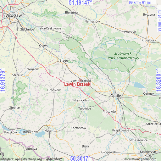
Lewin Brzeski GPS coordinates[2]
50° 44' 55.32" North, 17° 37' 0.768" East
| Map corner | latitude | longitude |
|---|---|---|
| Upper-left | 51.19147°, | 16.91376° |
| Center: | 50.7487°, | 17.61688° |
| Lower-right: | 50.3017°, | 18.32001° |
| Map W x H: | 98.9×98.9 km | = 61.5×61.5mi |
| max Lat: | 54.83135° ⇑61.5% North |
| Lewin Brzeski: | 50.7487° |
| min Lat: | ⇓38.5% South 49.21328° |
| min Long | Lewin Brzeski | max Long |
| 14.20249° | 17.61688° | 24.03723° |
| W 20.9%⇐ | ⇒79.1% E |
Elevation
Elevation of Lewin Brzeski is 149 m = 489 ft, and this is 42.4 m = 139 ft below average elevation for this country.
| Max E: |
974 m = 3196 ft | 58.7% |
| Avg. | 191.4 m = 628 ft | |
| Lewin Brzeski | 149 m = 489 ft | |
Min E: |
-3 m = -10 ft | 41.3% |
See also: Poland elevation on elevation.city.
Geographical zone
Lewin Brzeski is located in North temperate zone (between Tropic of Cancer and the Arctic Circle). Distance of this North polar circle is 1758.4 km =1092.6 mi to North.| Distance of | km | miles | from Lewin Brzeski |
|---|---|---|---|
| North Pole | 4364.3 | 2711.8 | to North |
| Arctic Circle | 1758.4 | 1092.6 | to North |
| Tropic Cancer | 3036.8 | 1887 | to South |
| Equator | 5642.7 | 3506.2 | to South |


Nearby cities:
15 places around Lewin Brzeski: (largest is in red/bold)
• Borkowice
7 km =4.3 mi,  96°
96°
• Brzeg
16.3 km =10.1 mi,  319°
319°
• Chrościna
16.9 km =10.5 mi,  123°
123°
• Chróścice
14.2 km =8.8 mi,  75°
75°
• Dobrzeń Wielki
16.3 km =10.1 mi, 82°
• Dąbrowa
11.8 km =7.3 mi,  127°
127°
• Karczów
12.8 km =8 mi,  113°
113°
• Krzyżowice
12.6 km =7.8 mi,  301°
301°
• Michałow
7.7 km =4.8 mi,  266°
266°
• Niemodlin
11.9 km =7.4 mi,  179°
179°
• Olszanka
11 km =6.8 mi, 298°
• Pogorzela
9.7 km =6 mi, 296°
• Popielów
12.4 km =7.7 mi,  45°
45°
• Skorogoszcz
4.7 km =2.9 mi, 75°
• Łosiów
5.9 km =3.7 mi, 322°
Sources, notices
• [Note1] Compared only with cities in Poland existing in our database
• [Src1] Map data: © OpenStreetMap contributors (CC-BY-SA)
• [Src2] Other city data from geonames.org with taken over terms of usage.
• [Src3] Geographical zone / Annual Mean Temperature by Robert A. Rohde @ Wikipedia
