Tarnów Opolski geodata
Tarnów Opolski (Opole Voivodeship) is a populated place; located in Poland in Europe/Warsaw (GMT+2) time zone. With population of 3,800 people, there are 853 cities with bigger population in this country. Compared to other cities in Poland, 65.8% of cities are located further ↑North; 74.4% of cities are located further →East and 52.3% of cities have lower elevation than Tarnów Opolski. Note1
Administrative division(s):
- Level 1: Opole Voivodeship
- Level 2: Powiat opolski
- Level 3: Tarnów Opolski


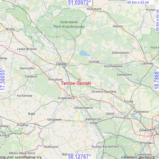
Tarnów Opolski GPS coordinates[2]
50° 34' 34.716" North, 18° 5' 1.212" East
| Map corner | latitude | longitude |
|---|---|---|
| Upper-left | 51.02072°, | 17.38055° |
| Center: | 50.57631°, | 18.08367° |
| Lower-right: | 50.12767°, | 18.7868° |
| Map W x H: | 99.3×99.3 km | = 61.7×61.7mi |
| max Lat: | 54.83135° ⇑65.8% North |
| Tarnów Opolski: | 50.57631° |
| min Lat: | ⇓34.2% South 49.21328° |
| min Long | Tarnów Opolski | max Long |
| 14.20249° | 18.08367° | 24.03723° |
| W 25.6%⇐ | ⇒74.4% E |
Elevation
Elevation of Tarnów Opolski is 178 m = 584 ft, and this is 13.4 m = 44 ft below average elevation for this country.
| Max E: |
974 m = 3196 ft | 47.7% |
| Avg. | 191.4 m = 628 ft | |
| Tarnów Opolski | 178 m = 584 ft | |
Min E: |
-3 m = -10 ft | 52.3% |
See also: Poland elevation on elevation.city.
Geographical zone
Tarnów Opolski is located in North temperate zone (between Tropic of Cancer and the Arctic Circle). Distance of this North polar circle is 1777.6 km =1104.5 mi to North.| Distance of | km | miles | from Tarnów Opolski |
|---|---|---|---|
| North Pole | 4383.5 | 2723.8 | to North |
| Arctic Circle | 1777.6 | 1104.5 | to North |
| Tropic Cancer | 3017.6 | 1875 | to South |
| Equator | 5623.6 | 3494.3 | to South |


Nearby cities:
15 places around Tarnów Opolski: (largest is in red/bold)
• Chmielowice
17.3 km =10.7 mi,  298°
298°
• Chrząstowice
10 km =6.2 mi,  355°
355°
• Gogolin
10.4 km =6.5 mi,  205°
205°
• Górażdże
7.4 km =4.6 mi,  224°
224°
• Izbicko
5.1 km =3.2 mi,  95°
95°
• Kosorowice
2.7 km =1.7 mi,  257°
257°
• Krapkowice
14 km =8.7 mi, 216°
• Kąty Opolskie
7.9 km =4.9 mi, 256°
• Nakło
2.5 km =1.6 mi,  81°
81°
• Opole
15.4 km =9.6 mi,  313°
313°
• Ozimek
14.7 km =9.1 mi,  38°
38°
• Prószków
15 km =9.3 mi,  270°
270°
• Rozwadza
15.8 km =9.8 mi,  175°
175°
• Strzelce Opolskie
17 km =10.6 mi,  115°
115°
• Zdzieszowice
17.1 km =10.6 mi,  170°
170°
Sources, notices
• [Note1] Compared only with cities in Poland existing in our database
• [Src1] Map data: © OpenStreetMap contributors (CC-BY-SA)
• [Src2] Other city data from geonames.org with taken over terms of usage.
• [Src3] Geographical zone / Annual Mean Temperature by Robert A. Rohde @ Wikipedia
