Rozwadza geodata
Rozwadza (Opole Voivodeship) is a populated place; located in Poland in Europe/Warsaw (GMT+2) time zone. With population of 1,100 people, there are 2307 cities with bigger population in this country. Compared to other cities in Poland, 68.7% of cities are located further ↑North; 74.2% of cities are located further →East and 52% of cities have lower elevation than Rozwadza. Note1
Administrative division(s):
- Level 1: Opole Voivodeship
- Level 2: Powiat krapkowicki
- Level 3: Zdzieszowice


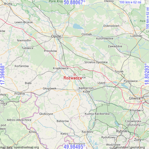
Rozwadza GPS coordinates[2]
50° 26' 5.748" North, 18° 5' 59.28" East
| Map corner | latitude | longitude |
|---|---|---|
| Upper-left | 50.88067°, | 17.39668° |
| Center: | 50.43493°, | 18.0998° |
| Lower-right: | 49.98495°, | 18.80293° |
| Map W x H: | 99.6×99.6 km | = 61.9×61.9mi |
| max Lat: | 54.83135° ⇑68.7% North |
| Rozwadza: | 50.43493° |
| min Lat: | ⇓31.3% South 49.21328° |
| min Long | Rozwadza | max Long |
| 14.20249° | 18.0998° | 24.03723° |
| W 25.8%⇐ | ⇒74.2% E |
Elevation
Elevation of Rozwadza is 177 m = 581 ft, and this is 14.4 m = 47 ft below average elevation for this country.
| Max E: |
974 m = 3196 ft | 48% |
| Avg. | 191.4 m = 628 ft | |
| Rozwadza | 177 m = 581 ft | |
Min E: |
-3 m = -10 ft | 52% |
See also: Poland elevation on elevation.city.
Geographical zone
Rozwadza is located in North temperate zone (between Tropic of Cancer and the Arctic Circle). Distance of this North polar circle is 1793.3 km =1114.3 mi to North.| Distance of | km | miles | from Rozwadza |
|---|---|---|---|
| North Pole | 4399.2 | 2733.5 | to North |
| Arctic Circle | 1793.3 | 1114.3 | to North |
| Tropic Cancer | 3001.9 | 1865.3 | to South |
| Equator | 5607.8 | 3484.5 | to South |


Nearby cities:
15 places around Rozwadza: (largest is in red/bold)
• Dobieszowice
9.6 km =6 mi,  213°
213°
• Gogolin
8.5 km =5.3 mi,  318°
318°
• Górażdże
12.2 km =7.6 mi,  328°
328°
• Januszkowice
5.5 km =3.4 mi,  151°
151°
• Komorno
8.8 km =5.5 mi,  191°
191°
• Koźle
11.5 km =7.1 mi,  164°
164°
• Krapkowice
10.5 km =6.5 mi,  295°
295°
• Leśnica
6.2 km =3.9 mi,  94°
94°
• Poborszów
6.8 km =4.2 mi, 189°
• Pokrzywnica
11.7 km =7.3 mi, 193°
• Raszowa
6.9 km =4.3 mi,  126°
126°
• Twardawa
12.8 km =8 mi,  217°
217°
• Walce
9.6 km =6 mi, 224°
• Większyce
10.9 km =6.8 mi,  179°
179°
• Zdzieszowice
2 km =1.2 mi,  123°
123°
Sources, notices
• [Note1] Compared only with cities in Poland existing in our database
• [Src1] Map data: © OpenStreetMap contributors (CC-BY-SA)
• [Src2] Other city data from geonames.org with taken over terms of usage.
• [Src3] Geographical zone / Annual Mean Temperature by Robert A. Rohde @ Wikipedia
