Gogolin geodata
Gogolin (Opole Voivodeship) is a seat of a third-order administrative division; located in Poland in Europe/Warsaw (GMT+2) time zone. With population of 6,077 people, there are 597 cities with bigger population in this country. Compared to other cities in Poland, 67.4% of cities are located further ↑North; 74.9% of cities are located further →East and 50.2% of cities have lower elevation than Gogolin. Note1


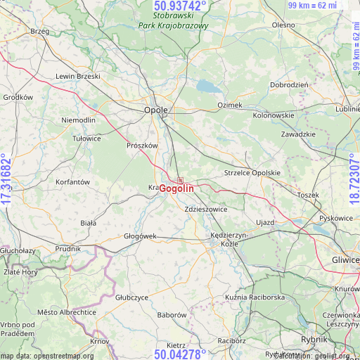
Gogolin GPS coordinates[2]
50° 29' 31.992" North, 18° 1' 11.784" East
| Map corner | latitude | longitude |
|---|---|---|
| Upper-left | 50.93742°, | 17.31682° |
| Center: | 50.49222°, | 18.01994° |
| Lower-right: | 50.04278°, | 18.72307° |
| Map W x H: | 99.5×99.5 km | = 61.8×61.8mi |
| max Lat: | 54.83135° ⇑67.4% North |
| Gogolin: | 50.49222° |
| min Lat: | ⇓32.6% South 49.21328° |
| min Long | Gogolin | max Long |
| 14.20249° | 18.01994° | 24.03723° |
| W 25.1%⇐ | ⇒74.9% E |
Elevation
Elevation of Gogolin is 172 m = 564 ft, and this is 19.4 m = 64 ft below average elevation for this country.
| Max E: |
974 m = 3196 ft | 49.8% |
| Avg. | 191.4 m = 628 ft | |
| Gogolin | 172 m = 564 ft | |
Min E: |
-3 m = -10 ft | 50.2% |
See also: Poland elevation on elevation.city.
Geographical zone
Gogolin is located in North temperate zone (between Tropic of Cancer and the Arctic Circle). Distance of this North polar circle is 1787 km =1110.4 mi to North.| Distance of | km | miles | from Gogolin |
|---|---|---|---|
| North Pole | 4392.9 | 2729.6 | to North |
| Arctic Circle | 1787 | 1110.4 | to North |
| Tropic Cancer | 3008.3 | 1869.3 | to South |
| Equator | 5614.2 | 3488.5 | to South |


Nearby cities:
15 places around Gogolin: (largest is in red/bold)
• Dobra
9.1 km =5.7 mi,  240°
240°
• Górażdże
4.2 km =2.6 mi,  350°
350°
• Izbicko
13 km =8.1 mi,  47°
47°
• Kosorowice
9 km =5.6 mi,  12°
12°
• Krapkowice
4.3 km =2.7 mi, 243°
• Kórnica
12.7 km =7.9 mi,  219°
219°
• Kąty Opolskie
8.1 km =5 mi,  336°
336°
• Leśnica
13.6 km =8.5 mi,  120°
120°
• Nakło
12 km =7.5 mi,  35°
35°
• Poborszów
13.8 km =8.6 mi,  160°
160°
• Rozwadza
8.5 km =5.3 mi,  138°
138°
• Strzeleczki
12 km =7.5 mi,  253°
253°
• Tarnów Opolski
10.4 km =6.5 mi,  25°
25°
• Walce
13.3 km =8.3 mi,  184°
184°
• Zdzieszowice
10.5 km =6.5 mi, 135°
Sources, notices
• [Note1] Compared only with cities in Poland existing in our database
• [Src1] Map data: © OpenStreetMap contributors (CC-BY-SA)
• [Src2] Other city data from geonames.org with taken over terms of usage.
• [Src3] Geographical zone / Annual Mean Temperature by Robert A. Rohde @ Wikipedia
