Sompolno geodata
Sompolno (Greater Poland) is a seat of a third-order administrative division; located in Poland in Europe/Warsaw (GMT+2) time zone. With population of 3,610 people, there are 889 cities with bigger population in this country. Compared to other cities in Poland, 74.5% of cities are located further ↓South; 68% of cities are located further →East and 81.2% of cities have higher elevation than Sompolno. Note1


Sompolno GPS coordinates[2]
52° 23' 17.952" North, 18° 30' 10.152" East
| Map corner | latitude | longitude |
|---|---|---|
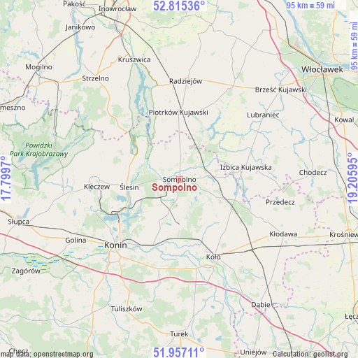
| Upper-left | 52.81536°, | 17.7997° |
| Center: | 52.38832°, | 18.50282° |
| Lower-right: | 51.95711°, | 19.20595° |
| Map W x H: | 95.4×95.4 km | = 59.3×59.3mi |
| max Lat: | 54.83135° ⇑25.5% North |
| Sompolno: | 52.38832° |
| min Lat: | ⇓74.5% South 49.21328° |
| min Long | Sompolno | max Long |
| 14.20249° | 18.50282° | 24.03723° |
| W 32%⇐ | ⇒68% E |
Elevation
Elevation of Sompolno is 97 m = 318 ft, and this is 94.4 m = 310 ft below average elevation for this country.
| Max E: |
974 m = 3196 ft | 81.2% |
| Avg. | 191.4 m = 628 ft | |
| Sompolno | 97 m = 318 ft | |
Min E: |
-3 m = -10 ft | 18.8% |
See also: Poland elevation on elevation.city.
Geographical zone
Sompolno is located in North temperate zone (between Tropic of Cancer and the Arctic Circle). Distance of this North polar circle is 1576.1 km =979.3 mi to North.| Distance of | km | miles | from Sompolno |
|---|---|---|---|
| North Pole | 4182 | 2598.6 | to North |
| Arctic Circle | 1576.1 | 979.3 | to North |
| Tropic Cancer | 3219.1 | 2000.3 | to South |
| Equator | 5825 | 3619.5 | to South |


Nearby cities:
15 places around Sompolno: (largest is in red/bold)
• Babiak
12.1 km =7.5 mi,  113°
113°
• Brdów
15.9 km =9.9 mi,  103°
103°
• Bytoń
19.8 km =12.3 mi,  18°
18°
• Izbica Kujawska
18 km =11.2 mi,  78°
78°
• Jeziora Wielkie
22.4 km =13.9 mi,  314°
314°
• Kleczew
22.2 km =13.8 mi,  264°
264°
• Kramsk
14.8 km =9.2 mi,  201°
201°
• Licheń Stary
13.1 km =8.1 mi,  229°
229°
• Osiek Mały
14.2 km =8.8 mi,  151°
151°
• Piotrków Kujawski
18.1 km =11.2 mi,  359°
359°
• Police
3.4 km =2.1 mi,  221°
221°
• Skulsk
15.6 km =9.7 mi, 311°
• Topólka
19.1 km =11.9 mi,  48°
48°
• Wierzbinek
5.8 km =3.6 mi,  5°
5°
• Ślesin
13.5 km =8.4 mi, 261°
Sources, notices
• [Note1] Compared only with cities in Poland existing in our database
• [Src1] Map data: © OpenStreetMap contributors (CC-BY-SA)
• [Src2] Other city data from geonames.org with taken over terms of usage.
• [Src3] Geographical zone / Annual Mean Temperature by Robert A. Rohde @ Wikipedia
