Smętowo Graniczne geodata
Smętowo Graniczne (Pomerania) is a populated place; located in Poland in Europe/Warsaw (GMT+2) time zone. With population of 3,000 people, there are 1040 cities with bigger population in this country. Compared to other cities in Poland, 91.8% of cities are located further ↓South; 65.2% of cities are located further →East and 87.2% of cities have higher elevation than Smętowo Graniczne. Note1
Administrative division(s):
- Level 1: Pomerania
- Level 2: Powiat starogardzki
- Level 3: Smętowo Graniczne


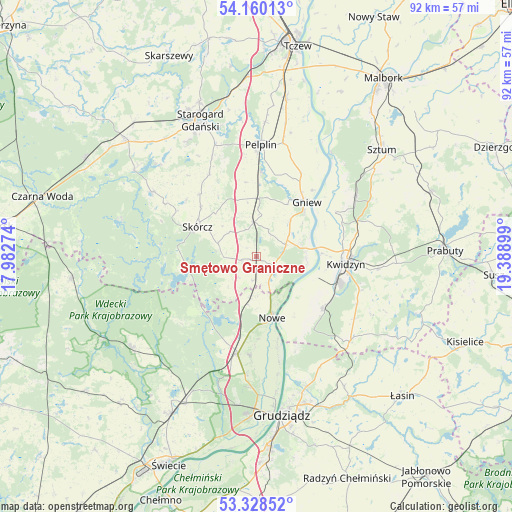
Smętowo Graniczne GPS coordinates[2]
53° 44' 46.968" North, 18° 41' 9.096" East
| Map corner | latitude | longitude |
|---|---|---|
| Upper-left | 54.16013°, | 17.98274° |
| Center: | 53.74638°, | 18.68586° |
| Lower-right: | 53.32852°, | 19.38899° |
| Map W x H: | 92.5×92.5 km | = 57.5×57.5mi |
| max Lat: | 54.83135° ⇑8.2% North |
| Smętowo Graniczne: | 53.74638° |
| min Lat: | ⇓91.8% South 49.21328° |
| min Long | Smętowo Granic | max Long |
| 14.20249° | 18.68586° | 24.03723° |
| W 34.8%⇐ | ⇒65.2% E |
Elevation
Elevation of Smętowo Graniczne is 84 m = 276 ft, and this is 107.4 m = 352 ft below average elevation for this country.
| Max E: |
974 m = 3196 ft | 87.2% |
| Avg. | 191.4 m = 628 ft | |
| Smętowo Graniczne | 84 m = 276 ft | |
Min E: |
-3 m = -10 ft | 12.8% |
See also: Poland elevation on elevation.city.
Geographical zone
Smętowo Graniczne is located in North temperate zone (between Tropic of Cancer and the Arctic Circle). Distance of this North polar circle is 1425.1 km =885.5 mi to North.| Distance of | km | miles | from Smętowo Graniczne |
|---|---|---|---|
| North Pole | 4031 | 2504.7 | to North |
| Arctic Circle | 1425.1 | 885.5 | to North |
| Tropic Cancer | 3370.1 | 2094.1 | to South |
| Equator | 5976 | 3713.3 | to South |


Nearby cities:
15 places around Smętowo Graniczne: (largest is in red/bold)
• Bobowo
17.5 km =10.9 mi,  330°
330°
• Gardeja
22.8 km =14.2 mi,  131°
131°
• Gniew
13.4 km =8.3 mi,  42°
42°
• Kopytkowo
2.6 km =1.6 mi,  247°
247°
• Kwidzyn
16.3 km =10.1 mi,  98°
98°
• Lubichowo
22.2 km =13.8 mi,  301°
301°
• Morzeszczyn
10.4 km =6.5 mi,  1°
1°
• Nowe
11.2 km =7 mi,  165°
165°
• Osiek
13.1 km =8.1 mi,  258°
258°
• Pelplin
20.2 km =12.6 mi, 2°
• Ryjewo
21.1 km =13.1 mi,  58°
58°
• Sadlinki
15 km =9.3 mi, 126°
• Skórcz
11.8 km =7.3 mi, 296°
• Warlubie
18 km =11.2 mi,  190°
190°
• Wielkie Walichnowy
21.9 km =13.6 mi,  29°
29°
Sources, notices
• [Note1] Compared only with cities in Poland existing in our database
• [Src1] Map data: © OpenStreetMap contributors (CC-BY-SA)
• [Src2] Other city data from geonames.org with taken over terms of usage.
• [Src3] Geographical zone / Annual Mean Temperature by Robert A. Rohde @ Wikipedia
