Gardeja geodata
Gardeja (Pomerania) is a populated place; located in Poland in Europe/Warsaw (GMT+2) time zone. With population of 2,500 people, there are 1240 cities with bigger population in this country. Compared to other cities in Poland, 90.7% of cities are located further ↓South; 61% of cities are located further →East and 87.2% of cities have higher elevation than Gardeja. Note1


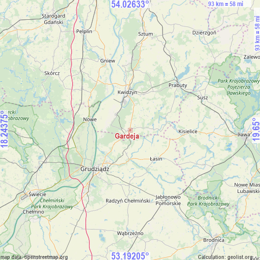
Gardeja GPS coordinates[2]
53° 36' 40.5" North, 18° 56' 48.732" East
| Map corner | latitude | longitude |
|---|---|---|
| Upper-left | 54.02633°, | 18.24375° |
| Center: | 53.61125°, | 18.94687° |
| Lower-right: | 53.19205°, | 19.65° |
| Map W x H: | 92.8×92.8 km | = 57.7×57.7mi |
| max Lat: | 54.83135° ⇑9.3% North |
| Gardeja: | 53.61125° |
| min Lat: | ⇓90.7% South 49.21328° |
| min Long | Gardeja | max Long |
| 14.20249° | 18.94687° | 24.03723° |
| W 39%⇐ | ⇒61% E |
Elevation
Elevation of Gardeja is 84 m = 276 ft, and this is 107.4 m = 352 ft below average elevation for this country.
| Max E: |
974 m = 3196 ft | 87.2% |
| Avg. | 191.4 m = 628 ft | |
| Gardeja | 84 m = 276 ft | |
Min E: |
-3 m = -10 ft | 12.8% |
See also: Poland elevation on elevation.city.
Geographical zone
Gardeja is located in North temperate zone (between Tropic of Cancer and the Arctic Circle). Distance of this North polar circle is 1440.2 km =894.9 mi to North.| Distance of | km | miles | from Gardeja |
|---|---|---|---|
| North Pole | 4046 | 2514.1 | to North |
| Arctic Circle | 1440.2 | 894.9 | to North |
| Tropic Cancer | 3355.1 | 2084.8 | to South |
| Equator | 5961 | 3704 | to South |


Nearby cities:
15 places around Gardeja: (largest is in red/bold)
• Dragasz
18 km =11.2 mi,  229°
229°
• Grudziądz
19 km =11.8 mi,  222°
222°
• Gruta
17.6 km =10.9 mi,  177°
177°
• Kisielice
20.9 km =13 mi,  90°
90°
• Kopytkowo
24.1 km =15 mi,  305°
305°
• Kwidzyn
12.7 km =7.9 mi,  355°
355°
• Nowe
15.1 km =9.4 mi,  286°
286°
• Prabuty
23.4 km =14.5 mi,  46°
46°
• Radzyń Chełmiński
25.2 km =15.7 mi, 181°
• Rogóźno
8.5 km =5.3 mi,  188°
188°
• Sadlinki
8 km =5 mi,  319°
319°
• Smętowo Graniczne
22.8 km =14.2 mi, 311°
• Warlubie
20.8 km =12.9 mi,  262°
262°
• Łasin
14 km =8.7 mi,  138°
138°
• Świecie nad Osą
21.2 km =13.2 mi,  151°
151°
Sources, notices
• [Note1] Compared only with cities in Poland existing in our database
• [Src1] Map data: © OpenStreetMap contributors (CC-BY-SA)
• [Src2] Other city data from geonames.org with taken over terms of usage.
• [Src3] Geographical zone / Annual Mean Temperature by Robert A. Rohde @ Wikipedia
