Sieroszewice geodata
Sieroszewice (Greater Poland) is a seat of a third-order administrative division; located in Poland in Europe/Warsaw (GMT+2) time zone. With population of 1,014 people, there are 2440 cities with bigger population in this country. Compared to other cities in Poland, 58.7% of cities are located further ↓South; 75.5% of cities are located further →East and 58.7% of cities have higher elevation than Sieroszewice. Note1


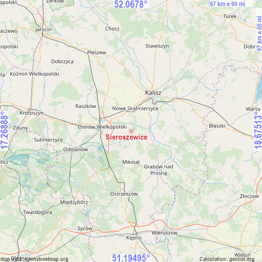
Sieroszewice GPS coordinates[2]
51° 38' 0.492" North, 17° 58' 19.2" East
| Map corner | latitude | longitude |
|---|---|---|
| Upper-left | 52.0678°, | 17.26888° |
| Center: | 51.63347°, | 17.972° |
| Lower-right: | 51.19495°, | 18.67513° |
| Map W x H: | 97.1×97 km | = 60.3×60.3mi |
| max Lat: | 54.83135° ⇑41.3% North |
| Sieroszewice: | 51.63347° |
| min Lat: | ⇓58.7% South 49.21328° |
| min Long | Sieroszewice | max Long |
| 14.20249° | 17.972° | 24.03723° |
| W 24.5%⇐ | ⇒75.5% E |
Elevation
Elevation of Sieroszewice is 149 m = 489 ft, and this is 42.4 m = 139 ft below average elevation for this country.
| Max E: |
974 m = 3196 ft | 58.7% |
| Avg. | 191.4 m = 628 ft | |
| Sieroszewice | 149 m = 489 ft | |
Min E: |
-3 m = -10 ft | 41.3% |
See also: Poland elevation on elevation.city.
Geographical zone
Sieroszewice is located in North temperate zone (between Tropic of Cancer and the Arctic Circle). Distance of this North polar circle is 1660.1 km =1031.5 mi to North.| Distance of | km | miles | from Sieroszewice |
|---|---|---|---|
| North Pole | 4266 | 2650.8 | to North |
| Arctic Circle | 1660.1 | 1031.5 | to North |
| Tropic Cancer | 3135.2 | 1948.1 | to South |
| Equator | 5741.1 | 3567.4 | to South |


Nearby cities:
15 places around Sieroszewice: (largest is in red/bold)
• Godziesze Wielkie
13.9 km =8.6 mi,  84°
84°
• Gorzyce Wielkie
16.7 km =10.4 mi,  271°
271°
• Grabów nad Prosną
17.5 km =10.9 mi,  144°
144°
• Janków Przygodzki
13.3 km =8.3 mi,  252°
252°
• Kalisz
16.4 km =10.2 mi,  30°
30°
• Mikstat
11.2 km =7 mi,  179°
179°
• Moszczanka
18.7 km =11.6 mi,  300°
300°
• Nowe Skalmierzyce
8.7 km =5.4 mi,  9°
9°
• Ostrów Wielkopolski
11.6 km =7.2 mi,  281°
281°
• Przybysławice
19.6 km =12.2 mi,  294°
294°
• Przygodzice
11.2 km =7 mi, 245°
• Psary
3.8 km =2.4 mi,  46°
46°
• Raszków
19.4 km =12.1 mi, 299°
• Skalmierzyce
7.5 km =4.7 mi,  355°
355°
• Sobótka
18 km =11.2 mi,  334°
334°
Sources, notices
• [Note1] Compared only with cities in Poland existing in our database
• [Src1] Map data: © OpenStreetMap contributors (CC-BY-SA)
• [Src2] Other city data from geonames.org with taken over terms of usage.
• [Src3] Geographical zone / Annual Mean Temperature by Robert A. Rohde @ Wikipedia
