Mikstat geodata
Mikstat (Greater Poland) is a seat of a third-order administrative division; located in Poland in Europe/Warsaw (GMT+2) time zone. With population of 1,832 people, there are 1589 cities with bigger population in this country. Compared to other cities in Poland, 56.9% of cities are located further ↓South; 75.5% of cities are located further →East and 58.9% of cities have lower elevation than Mikstat. Note1


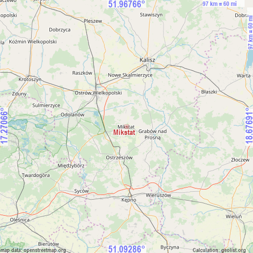
Mikstat GPS coordinates[2]
51° 31' 56.496" North, 17° 58' 25.608" East
| Map corner | latitude | longitude |
|---|---|---|
| Upper-left | 51.96766°, | 17.27066° |
| Center: | 51.53236°, | 17.97378° |
| Lower-right: | 51.09286°, | 18.67691° |
| Map W x H: | 97.3×97.3 km | = 60.5×60.5mi |
| max Lat: | 54.83135° ⇑43.1% North |
| Mikstat: | 51.53236° |
| min Lat: | ⇓56.9% South 49.21328° |
| min Long | Mikstat | max Long |
| 14.20249° | 17.97378° | 24.03723° |
| W 24.5%⇐ | ⇒75.5% E |
Elevation
Elevation of Mikstat is 197 m = 646 ft, and this is 5.6 m = 18 ft above average elevation for this country.
| Max E: |
974 m = 3196 ft | 41.1% |
| Mikstat | 197 m 646 ft | |
| Avg. | 191.4 m = 628 ft | |
Min E: |
-3 m = -10 ft | 58.9% |
See also: Poland elevation on elevation.city.
Geographical zone
Mikstat is located in North temperate zone (between Tropic of Cancer and the Arctic Circle). Distance of this North polar circle is 1671.3 km =1038.5 mi to North.| Distance of | km | miles | from Mikstat |
|---|---|---|---|
| North Pole | 4277.2 | 2657.7 | to North |
| Arctic Circle | 1671.3 | 1038.5 | to North |
| Tropic Cancer | 3123.9 | 1941.1 | to South |
| Equator | 5729.9 | 3560.4 | to South |


Nearby cities:
15 places around Mikstat: (largest is in red/bold)
• Brzeziny
20.7 km =12.9 mi,  70°
70°
• Doruchów
14.7 km =9.1 mi,  150°
150°
• Godziesze Wielkie
18.6 km =11.6 mi,  47°
47°
• Gorzyce Wielkie
20.5 km =12.7 mi,  304°
304°
• Grabów nad Prosną
10.5 km =6.5 mi,  106°
106°
• Janków Przygodzki
14.8 km =9.2 mi, 299°
• Kobyla Góra
19.4 km =12.1 mi,  208°
208°
• Kraszewice
17.1 km =10.6 mi,  95°
95°
• Nowe Skalmierzyce
19.8 km =12.3 mi,  3°
3°
• Ostrzeszów
12.1 km =7.5 mi,  193°
193°
• Ostrów Wielkopolski
17.9 km =11.1 mi,  319°
319°
• Przygodzice
12.3 km =7.6 mi, 302°
• Psary
14.1 km =8.8 mi,  10°
10°
• Sieroszewice
11.2 km =7 mi,  359°
359°
• Skalmierzyce
18.8 km =11.7 mi, 357°
Sources, notices
• [Note1] Compared only with cities in Poland existing in our database
• [Src1] Map data: © OpenStreetMap contributors (CC-BY-SA)
• [Src2] Other city data from geonames.org with taken over terms of usage.
• [Src3] Geographical zone / Annual Mean Temperature by Robert A. Rohde @ Wikipedia
