Rokitno geodata
Rokitno (Silesia) is a populated place; located in Poland in Europe/Warsaw (GMT+2) time zone. With population of 937 people, there are 2613 cities with bigger population in this country. Compared to other cities in Poland, 65.5% of cities are located further ↑North; 54.5% of cities are located further ←West and 81.4% of cities have lower elevation than Rokitno. Note1


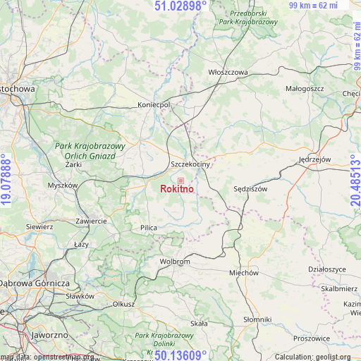
Rokitno GPS coordinates[2]
50° 35' 4.74" North, 19° 46' 55.2" East
| Map corner | latitude | longitude |
|---|---|---|
| Upper-left | 51.02898°, | 19.07888° |
| Center: | 50.58465°, | 19.782° |
| Lower-right: | 50.13609°, | 20.48513° |
| Map W x H: | 99.3×99.3 km | = 61.7×61.7mi |
| max Lat: | 54.83135° ⇑65.5% North |
| Rokitno: | 50.58465° |
| min Lat: | ⇓34.5% South 49.21328° |
| min Long | Rokitno | max Long |
| 14.20249° | 19.782° | 24.03723° |
| W 54.5%⇐ | ⇒45.5% E |
Elevation
Elevation of Rokitno is 273 m = 896 ft, and this is 81.6 m = 268 ft above average elevation for this country.
| Max E: |
974 m = 3196 ft | 18.6% |
| Rokitno | 273 m 896 ft | |
| Avg. | 191.4 m = 628 ft | |
Min E: |
-3 m = -10 ft | 81.4% |
See also: Poland elevation on elevation.city.
Geographical zone
Rokitno is located in North temperate zone (between Tropic of Cancer and the Arctic Circle). Distance of this North polar circle is 1776.7 km =1104 mi to North.| Distance of | km | miles | from Rokitno |
|---|---|---|---|
| North Pole | 4382.6 | 2723.2 | to North |
| Arctic Circle | 1776.7 | 1104 | to North |
| Tropic Cancer | 3018.6 | 1875.7 | to South |
| Equator | 5624.5 | 3494.9 | to South |


Nearby cities:
15 places around Rokitno: (largest is in red/bold)
• Bliżyce
16.8 km =10.4 mi,  288°
288°
• Goleniowy
8.6 km =5.3 mi,  50°
50°
• Irządze
8.3 km =5.2 mi,  304°
304°
• Kroczyce
15.2 km =9.4 mi,  260°
260°
• Kępie
17.8 km =11.1 mi,  141°
141°
• Lelów
15.6 km =9.7 mi,  314°
314°
• Marcinowice
17.6 km =10.9 mi,  121°
121°
• Moskorzew
12.9 km =8 mi,  57°
57°
• Nakło
8.9 km =5.5 mi,  333°
333°
• Pilica
15.7 km =9.8 mi,  214°
214°
• Psary
16.5 km =10.3 mi,  10°
10°
• Sokolniki
14.4 km =8.9 mi, 295°
• Szczekociny
5.6 km =3.5 mi,  32°
32°
• Słupia
13.7 km =8.5 mi,  82°
82°
• Żarnowiec
13 km =8.1 mi,  154°
154°
Sources, notices
• [Note1] Compared only with cities in Poland existing in our database
• [Src1] Map data: © OpenStreetMap contributors (CC-BY-SA)
• [Src2] Other city data from geonames.org with taken over terms of usage.
• [Src3] Geographical zone / Annual Mean Temperature by Robert A. Rohde @ Wikipedia
