Żarnowiec geodata
Żarnowiec (Silesia) is a populated place; located in Poland in Europe/Warsaw (GMT+2) time zone. With population of 738 people, there are 2994 cities with bigger population in this country. Compared to other cities in Poland, 67.7% of cities are located further ↑North; 56.1% of cities are located further ←West and 84.2% of cities have lower elevation than Żarnowiec. Note1


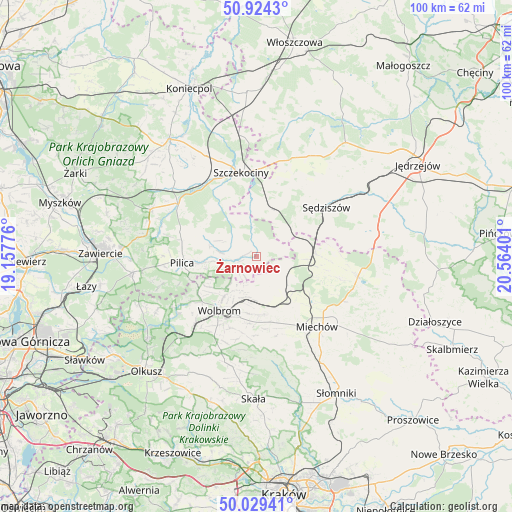
Żarnowiec GPS coordinates[2]
50° 28' 44.292" North, 19° 51' 39.168" East
| Map corner | latitude | longitude |
|---|---|---|
| Upper-left | 50.9243°, | 19.15776° |
| Center: | 50.47897°, | 19.86088° |
| Lower-right: | 50.02941°, | 20.56401° |
| Map W x H: | 99.5×99.5 km | = 61.8×61.8mi |
| max Lat: | 54.83135° ⇑67.7% North |
| Żarnowiec: | 50.47897° |
| min Lat: | ⇓32.3% South 49.21328° |
| min Long | Żarnowiec | max Long |
| 14.20249° | 19.86088° | 24.03723° |
| W 56.1%⇐ | ⇒43.9% E |
Elevation
Elevation of Żarnowiec is 286 m = 938 ft, and this is 94.6 m = 310 ft above average elevation for this country.
| Max E: |
974 m = 3196 ft | 15.8% |
| Żarnowiec | 286 m 938 ft | |
| Avg. | 191.4 m = 628 ft | |
Min E: |
-3 m = -10 ft | 84.2% |
See also: Poland elevation on elevation.city.
Geographical zone
Żarnowiec is located in North temperate zone (between Tropic of Cancer and the Arctic Circle). Distance of this North polar circle is 1788.4 km =1111.3 mi to North.| Distance of | km | miles | from Żarnowiec |
|---|---|---|---|
| North Pole | 4394.3 | 2730.5 | to North |
| Arctic Circle | 1788.4 | 1111.3 | to North |
| Tropic Cancer | 3006.8 | 1868.3 | to South |
| Equator | 5612.7 | 3487.6 | to South |


Nearby cities:
15 places around Żarnowiec: (largest is in red/bold)
• Goleniowy
17.2 km =10.7 mi,  3°
3°
• Kozłów
11.6 km =7.2 mi,  87°
87°
• Kępie
5.8 km =3.6 mi,  112°
112°
• Marcinowice
9.9 km =6.2 mi,  74°
74°
• Miechów
18 km =11.2 mi,  139°
139°
• Miechów Charsznica
11.2 km =7 mi,  145°
145°
• Pilica
14.5 km =9 mi,  265°
265°
• Poręba Górna
14.7 km =9.1 mi,  199°
199°
• Rokitno
13 km =8.1 mi,  334°
334°
• Szczekociny
16.6 km =10.3 mi,  351°
351°
• Sędziszów
16.8 km =10.4 mi,  54°
54°
• Słupia
15.7 km =9.8 mi,  30°
30°
• Wierzchowisko
12 km =7.5 mi, 195°
• Wolbrom
13.2 km =8.2 mi,  213°
213°
• Zarzecze
17.1 km =10.6 mi,  223°
223°
Sources, notices
• [Note1] Compared only with cities in Poland existing in our database
• [Src1] Map data: © OpenStreetMap contributors (CC-BY-SA)
• [Src2] Other city data from geonames.org with taken over terms of usage.
• [Src3] Geographical zone / Annual Mean Temperature by Robert A. Rohde @ Wikipedia
