Kępie geodata
Kępie (Lesser Poland) is a populated place; located in Poland in Europe/Warsaw (GMT+2) time zone. With population of 640 people, there are 3187 cities with bigger population in this country. Compared to other cities in Poland, 68% of cities are located further ↑North; 57.3% of cities are located further ←West and 86.4% of cities have lower elevation than Kępie. Note1


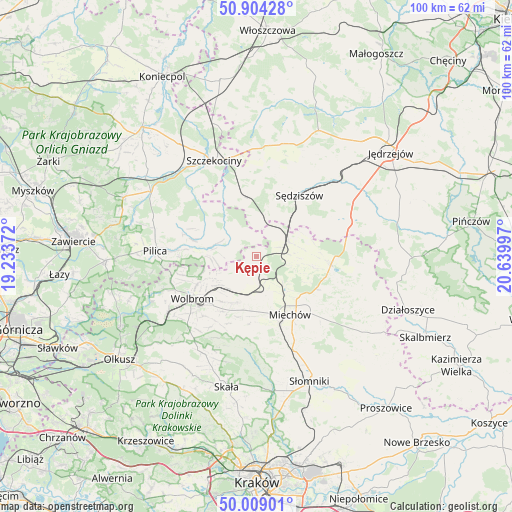
Kępie GPS coordinates[2]
50° 27' 31.536" North, 19° 56' 12.624" East
| Map corner | latitude | longitude |
|---|---|---|
| Upper-left | 50.90428°, | 19.23372° |
| Center: | 50.45876°, | 19.93684° |
| Lower-right: | 50.00901°, | 20.63997° |
| Map W x H: | 99.5×99.5 km | = 61.8×61.8mi |
| max Lat: | 54.83135° ⇑68% North |
| Kępie: | 50.45876° |
| min Lat: | ⇓32% South 49.21328° |
| min Long | Kępie | max Long |
| 14.20249° | 19.93684° | 24.03723° |
| W 57.3%⇐ | ⇒42.7% E |
Elevation
Elevation of Kępie is 298 m = 978 ft, and this is 106.6 m = 350 ft above average elevation for this country.
| Max E: |
974 m = 3196 ft | 13.6% |
| Kępie | 298 m 978 ft | |
| Avg. | 191.4 m = 628 ft | |
Min E: |
-3 m = -10 ft | 86.4% |
See also: Poland elevation on elevation.city.
Geographical zone
Kępie is located in North temperate zone (between Tropic of Cancer and the Arctic Circle). Distance of this North polar circle is 1790.7 km =1112.7 mi to North.| Distance of | km | miles | from Kępie |
|---|---|---|---|
| North Pole | 4396.6 | 2731.9 | to North |
| Arctic Circle | 1790.7 | 1112.7 | to North |
| Tropic Cancer | 3004.6 | 1867 | to South |
| Equator | 5610.5 | 3486.2 | to South |


Nearby cities:
15 places around Kępie: (largest is in red/bold)
• Kozłów
6.8 km =4.2 mi,  65°
65°
• Książ Wielki
14.5 km =9 mi,  96°
96°
• Marcinowice
6.4 km =4 mi,  40°
40°
• Miechów
13.1 km =8.1 mi,  150°
150°
• Miechów Charsznica
7 km =4.3 mi,  172°
172°
• Pilica
19.8 km =12.3 mi,  272°
272°
• Poręba Górna
15.6 km =9.7 mi,  221°
221°
• Rokitno
17.8 km =11.1 mi,  321°
321°
• Sędziszów
14.6 km =9.1 mi, 35°
• Słupia
16 km =9.9 mi,  9°
9°
• Wierzchowisko
12.7 km =7.9 mi, 222°
• Wodzisław
19.3 km =12 mi, 69°
• Wolbrom
15.4 km =9.6 mi,  235°
235°
• Zarzecze
19.9 km =12.4 mi, 239°
• Żarnowiec
5.8 km =3.6 mi,  292°
292°
Sources, notices
• [Note1] Compared only with cities in Poland existing in our database
• [Src1] Map data: © OpenStreetMap contributors (CC-BY-SA)
• [Src2] Other city data from geonames.org with taken over terms of usage.
• [Src3] Geographical zone / Annual Mean Temperature by Robert A. Rohde @ Wikipedia
