Świerczów geodata
Świerczów (Opole Voivodeship) is a seat of a third-order administrative division; located in Poland in Europe/Warsaw (GMT+2) time zone. With population of 492 people, there are 3545 cities with bigger population in this country. Compared to other cities in Poland, 56.2% of cities are located further ↑North; 77.6% of cities are located further →East and 56% of cities have higher elevation than Świerczów. Note1
Administrative division(s):
- Level 1: Opole Voivodeship
- Level 2: Powiat namysłowski
- Level 3: Świerczów


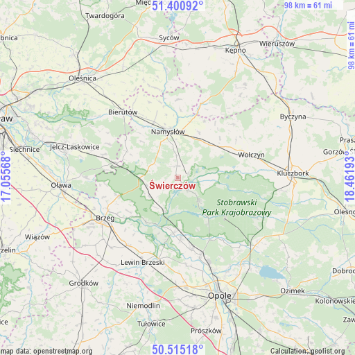
Świerczów GPS coordinates[2]
50° 57' 36.576" North, 17° 45' 31.68" East
| Map corner | latitude | longitude |
|---|---|---|
| Upper-left | 51.40092°, | 17.05568° |
| Center: | 50.96016°, | 17.7588° |
| Lower-right: | 50.51518°, | 18.46193° |
| Map W x H: | 98.5×98.5 km | = 61.2×61.2mi |
| max Lat: | 54.83135° ⇑56.2% North |
| Świerczów: | 50.96016° |
| min Lat: | ⇓43.8% South 49.21328° |
| min Long | Świerczów | max Long |
| 14.20249° | 17.7588° | 24.03723° |
| W 22.4%⇐ | ⇒77.6% E |
Elevation
Elevation of Świerczów is 156 m = 512 ft, and this is 35.4 m = 116 ft below average elevation for this country.
| Max E: |
974 m = 3196 ft | 56% |
| Avg. | 191.4 m = 628 ft | |
| Świerczów | 156 m = 512 ft | |
Min E: |
-3 m = -10 ft | 44% |
See also: Poland elevation on elevation.city.
Geographical zone
Świerczów is located in North temperate zone (between Tropic of Cancer and the Arctic Circle). Distance of this North polar circle is 1734.9 km =1078 mi to North.| Distance of | km | miles | from Świerczów |
|---|---|---|---|
| North Pole | 4340.8 | 2697.2 | to North |
| Arctic Circle | 1734.9 | 1078 | to North |
| Tropic Cancer | 3060.3 | 1901.6 | to South |
| Equator | 5666.2 | 3520.8 | to South |


Nearby cities:
15 places around Świerczów: (largest is in red/bold)
• Chróścice
20.3 km =12.6 mi,  169°
169°
• Domaradz
7.6 km =4.7 mi,  99°
99°
• Domaszowice
12.9 km =8 mi,  44°
44°
• Idzikowice
21.2 km =13.2 mi,  347°
347°
• Kup
19.2 km =11.9 mi,  152°
152°
• Lubsza
17.3 km =10.7 mi,  253°
253°
• Miłocice
21.5 km =13.4 mi,  296°
296°
• Murów
17 km =10.6 mi,  129°
129°
• Namysłów
13.1 km =8.1 mi, 348°
• Pokój
8.4 km =5.2 mi,  139°
139°
• Popielów
14.9 km =9.3 mi,  184°
184°
• Rychtal
21.6 km =13.4 mi,  17°
17°
• Strzelce
13.7 km =8.5 mi,  31°
31°
• Wilków
17.1 km =10.6 mi,  336°
336°
• Wołczyn
21.4 km =13.3 mi,  72°
72°
Sources, notices
• [Note1] Compared only with cities in Poland existing in our database
• [Src1] Map data: © OpenStreetMap contributors (CC-BY-SA)
• [Src2] Other city data from geonames.org with taken over terms of usage.
• [Src3] Geographical zone / Annual Mean Temperature by Robert A. Rohde @ Wikipedia
