Pielgrzymka geodata
Pielgrzymka (Lower Silesia) is a populated place; located in Poland in Europe/Warsaw (GMT+2) time zone. With population of 910 people, there are 2657 cities with bigger population in this country. Compared to other cities in Poland, 52% of cities are located further ↑North; 93.5% of cities are located further →East and 69.6% of cities have lower elevation than Pielgrzymka. Note1


Pielgrzymka GPS coordinates[2]
51° 6' 57.096" North, 15° 48' 49.968" East
| Map corner | latitude | longitude |
|---|---|---|
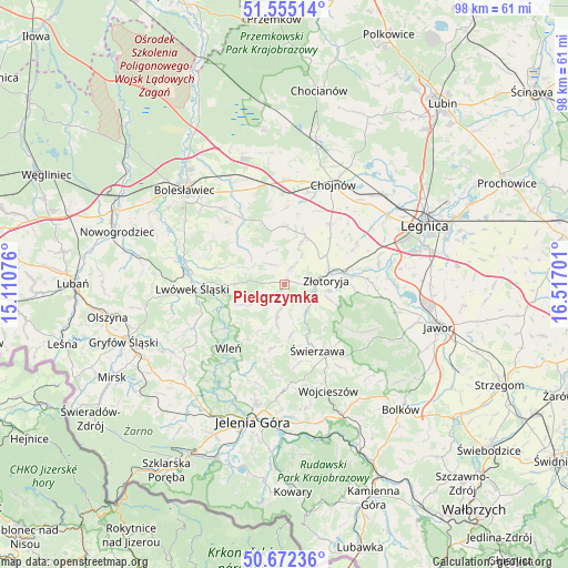
| Upper-left | 51.55514°, | 15.11076° |
| Center: | 51.11586°, | 15.81388° |
| Lower-right: | 50.67236°, | 16.51701° |
| Map W x H: | 98.2×98.2 km | = 61×61mi |
| max Lat: | 54.83135° ⇑52% North |
| Pielgrzymka: | 51.11586° |
| min Lat: | ⇓48% South 49.21328° |
| min Long | Pielgrzymka | max Long |
| 14.20249° | 15.81388° | 24.03723° |
| W 6.5%⇐ | ⇒93.5% E |
Elevation
Elevation of Pielgrzymka is 228 m = 748 ft, and this is 36.6 m = 120 ft above average elevation for this country.
| Max E: |
974 m = 3196 ft | 30.4% |
| Pielgrzymka | 228 m 748 ft | |
| Avg. | 191.4 m = 628 ft | |
Min E: |
-3 m = -10 ft | 69.6% |
See also: Poland elevation on elevation.city.
Geographical zone
Pielgrzymka is located in North temperate zone (between Tropic of Cancer and the Arctic Circle). Distance of this North polar circle is 1717.6 km =1067.3 mi to North.| Distance of | km | miles | from Pielgrzymka |
|---|---|---|---|
| North Pole | 4323.5 | 2686.5 | to North |
| Arctic Circle | 1717.6 | 1067.3 | to North |
| Tropic Cancer | 3077.6 | 1912.3 | to South |
| Equator | 5683.6 | 3531.6 | to South |


Nearby cities:
15 places around Pielgrzymka: (largest is in red/bold)
• Chojnów
19.5 km =12.1 mi,  25°
25°
• Krotoszyce
16.5 km =10.3 mi,  77°
77°
• Krzywa
18.6 km =11.6 mi,  359°
359°
• Lwówek Śląski
15.9 km =9.9 mi,  267°
267°
• Olszanica
10.1 km =6.3 mi,  354°
354°
• Pilchowice
19.5 km =12.1 mi,  218°
218°
• Sędziszowa
10.9 km =6.8 mi,  156°
156°
• Warta Bolesławiecka
16.4 km =10.2 mi,  321°
321°
• Wilków
8.4 km =5.2 mi,  108°
108°
• Wleń
14.7 km =9.1 mi, 221°
• Wojcieszów
19.7 km =12.2 mi, 157°
• Zagrodno
9.1 km =5.7 mi,  23°
23°
• Złotoryja
7.5 km =4.7 mi, 81°
• Łaziska
19.9 km =12.4 mi,  313°
313°
• Świerzawa
12.7 km =7.9 mi,  153°
153°
Sources, notices
• [Note1] Compared only with cities in Poland existing in our database
• [Src1] Map data: © OpenStreetMap contributors (CC-BY-SA)
• [Src2] Other city data from geonames.org with taken over terms of usage.
• [Src3] Geographical zone / Annual Mean Temperature by Robert A. Rohde @ Wikipedia
