Krotoszyce geodata
Krotoszyce (Lower Silesia) is a populated place; located in Poland in Europe/Warsaw (GMT+2) time zone. With population of 569 people, there are 3361 cities with bigger population in this country. Compared to other cities in Poland, 50.5% of cities are located further ↑North; 92.3% of cities are located further →East and 54.5% of cities have higher elevation than Krotoszyce. Note1


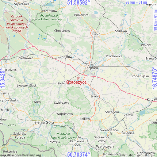
Krotoszyce GPS coordinates[2]
51° 8' 48.984" North, 16° 2' 44.232" East
| Map corner | latitude | longitude |
|---|---|---|
| Upper-left | 51.58592°, | 15.3425° |
| Center: | 51.14694°, | 16.04562° |
| Lower-right: | 50.70374°, | 16.74875° |
| Map W x H: | 98.1×98.1 km | = 61×61mi |
| max Lat: | 54.83135° ⇑50.5% North |
| Krotoszyce: | 51.14694° |
| min Lat: | ⇓49.5% South 49.21328° |
| min Long | Krotoszyce | max Long |
| 14.20249° | 16.04562° | 24.03723° |
| W 7.7%⇐ | ⇒92.3% E |
Elevation
Elevation of Krotoszyce is 160 m = 525 ft, and this is 31.4 m = 103 ft below average elevation for this country.
| Max E: |
974 m = 3196 ft | 54.5% |
| Avg. | 191.4 m = 628 ft | |
| Krotoszyce | 160 m = 525 ft | |
Min E: |
-3 m = -10 ft | 45.5% |
See also: Poland elevation on elevation.city.
Geographical zone
Krotoszyce is located in North temperate zone (between Tropic of Cancer and the Arctic Circle). Distance of this North polar circle is 1714.2 km =1065.2 mi to North.| Distance of | km | miles | from Krotoszyce |
|---|---|---|---|
| North Pole | 4320.1 | 2684.4 | to North |
| Arctic Circle | 1714.2 | 1065.2 | to North |
| Tropic Cancer | 3081.1 | 1914.5 | to South |
| Equator | 5687 | 3533.7 | to South |


Nearby cities:
15 places around Krotoszyce: (largest is in red/bold)
• Chojnów
16 km =9.9 mi,  331°
331°
• Jawor
14.8 km =9.2 mi,  135°
135°
• Kunice
16.4 km =10.2 mi,  59°
59°
• Legnica
10.7 km =6.6 mi,  49°
49°
• Legnickie Pole
13.7 km =8.5 mi,  91°
91°
• Miłkowice
12.3 km =7.6 mi,  8°
8°
• Męcinka
8.9 km =5.5 mi,  156°
156°
• Olszanica
18.3 km =11.4 mi,  291°
291°
• Paszowice
16.9 km =10.5 mi,  153°
153°
• Pielgrzymka
16.5 km =10.3 mi,  257°
257°
• Sędziszowa
17.9 km =11.1 mi,  221°
221°
• Wilków
10.2 km =6.3 mi,  233°
233°
• Zagrodno
13.5 km =8.4 mi, 291°
• Złotoryja
9.1 km =5.7 mi, 255°
• Świerzawa
18.2 km =11.3 mi, 215°
Sources, notices
• [Note1] Compared only with cities in Poland existing in our database
• [Src1] Map data: © OpenStreetMap contributors (CC-BY-SA)
• [Src2] Other city data from geonames.org with taken over terms of usage.
• [Src3] Geographical zone / Annual Mean Temperature by Robert A. Rohde @ Wikipedia
