Młynary geodata
Młynary (Warmia-Masuria) is a seat of a third-order administrative division; located in Poland in Europe/Warsaw (GMT+2) time zone. With population of 1,815 people, there are 1602 cities with bigger population in this country. Compared to other cities in Poland, 96.1% of cities are located further ↓South; 53.2% of cities are located further ←West and 94% of cities have higher elevation than Młynary. Note1


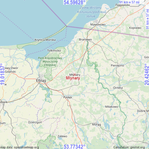
Młynary GPS coordinates[2]
54° 11' 12.84" North, 19° 43' 17.364" East
| Map corner | latitude | longitude |
|---|---|---|
| Upper-left | 54.59628°, | 19.01837° |
| Center: | 54.1869°, | 19.72149° |
| Lower-right: | 53.77342°, | 20.42462° |
| Map W x H: | 91.5×91.5 km | = 56.9×56.9mi |
| max Lat: | 54.83135° ⇑3.9% North |
| Młynary: | 54.1869° |
| min Lat: | ⇓96.1% South 49.21328° |
| min Long | Młynary | max Long |
| 14.20249° | 19.72149° | 24.03723° |
| W 53.2%⇐ | ⇒46.8% E |
Elevation
Elevation of Młynary is 54 m = 177 ft, and this is 137.4 m = 451 ft below average elevation for this country.
| Max E: |
974 m = 3196 ft | 94% |
| Avg. | 191.4 m = 628 ft | |
| Młynary | 54 m = 177 ft | |
Min E: |
-3 m = -10 ft | 6% |
See also: Poland elevation on elevation.city.
Geographical zone
Młynary is located in North temperate zone (between Tropic of Cancer and the Arctic Circle). Distance of this North polar circle is 1376.2 km =855.1 mi to North.| Distance of | km | miles | from Młynary |
|---|---|---|---|
| North Pole | 3982 | 2474.3 | to North |
| Arctic Circle | 1376.2 | 855.1 | to North |
| Tropic Cancer | 3419.1 | 2124.5 | to South |
| Equator | 6025 | 3743.8 | to South |


Nearby cities:
15 places around Młynary: (largest is in red/bold)
• Braniewo
22.4 km =13.9 mi,  16°
16°
• Elbląg
20.7 km =12.9 mi,  259°
259°
• Frombork
19.2 km =11.9 mi,  351°
351°
• Gronowo Elbląskie
29.3 km =18.2 mi,  247°
247°
• Gronowo Górne
17.9 km =11.1 mi, 252°
• Kamiennik Wielki
11.5 km =7.1 mi,  268°
268°
• Krynica Morska
28.1 km =17.5 mi,  320°
320°
• Markusy
25.9 km =16.1 mi,  234°
234°
• Małdyty
29.7 km =18.5 mi,  177°
177°
• Orneta
28 km =17.4 mi,  106°
106°
• Pasłęk
14.5 km =9 mi,  196°
196°
• Pieniężno
27 km =16.8 mi,  78°
78°
• Rychliki
25.8 km =16 mi,  209°
209°
• Suchacz
21.1 km =13.1 mi,  301°
301°
• Tolkmicko
19.5 km =12.1 mi, 319°
Sources, notices
• [Note1] Compared only with cities in Poland existing in our database
• [Src1] Map data: © OpenStreetMap contributors (CC-BY-SA)
• [Src2] Other city data from geonames.org with taken over terms of usage.
• [Src3] Geographical zone / Annual Mean Temperature by Robert A. Rohde @ Wikipedia
