Łąck geodata
Łąck (Mazovia) is a seat of a third-order administrative division; located in Poland in Europe/Warsaw (GMT+2) time zone. With population of 1,350 people, there are 2019 cities with bigger population in this country. Compared to other cities in Poland, 75.9% of cities are located further ↓South; 50.9% of cities are located further ←West and 87.2% of cities have higher elevation than Łąck. Note1


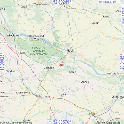
Łąck GPS coordinates[2]
52° 27' 58.356" North, 19° 36' 40.932" East
| Map corner | latitude | longitude |
|---|---|---|
| Upper-left | 52.89249°, | 18.90825° |
| Center: | 52.46621°, | 19.61137° |
| Lower-right: | 52.03576°, | 20.3145° |
| Map W x H: | 95.3×95.3 km | = 59.2×59.2mi |
| max Lat: | 54.83135° ⇑24.1% North |
| Łąck: | 52.46621° |
| min Lat: | ⇓75.9% South 49.21328° |
| min Long | Łąck | max Long |
| 14.20249° | 19.61137° | 24.03723° |
| W 50.9%⇐ | ⇒49.1% E |
Elevation
Elevation of Łąck is 84 m = 276 ft, and this is 107.4 m = 352 ft below average elevation for this country.
| Max E: |
974 m = 3196 ft | 87.2% |
| Avg. | 191.4 m = 628 ft | |
| Łąck | 84 m = 276 ft | |
Min E: |
-3 m = -10 ft | 12.8% |
See also: Poland elevation on elevation.city.
Geographical zone
Łąck is located in North temperate zone (between Tropic of Cancer and the Arctic Circle). Distance of this North polar circle is 1567.5 km =974 mi to North.| Distance of | km | miles | from Łąck |
|---|---|---|---|
| North Pole | 4173.4 | 2593.2 | to North |
| Arctic Circle | 1567.5 | 974 | to North |
| Tropic Cancer | 3227.8 | 2005.7 | to South |
| Equator | 5833.7 | 3624.9 | to South |


Nearby cities:
15 places around Łąck: (largest is in red/bold)
• Baruchowo
23.7 km =14.7 mi,  277°
277°
• Biała
15.7 km =9.8 mi,  9°
9°
• Gostynin
10.9 km =6.8 mi,  247°
247°
• Gąbin
11.3 km =7 mi,  131°
131°
• Maszewo Duże
12.7 km =7.9 mi, 5°
• Nowy Duninów
15.7 km =9.8 mi,  325°
325°
• Oporów
22.7 km =14.1 mi,  188°
188°
• Pacyna
19.4 km =12.1 mi,  159°
159°
• Płock
11 km =6.8 mi,  35°
35°
• Radzanowo
22.3 km =13.9 mi,  57°
57°
• Sanniki
23 km =14.3 mi, 130°
• Stary Barcik
17.9 km =11.1 mi,  122°
122°
• Strzelce
21.8 km =13.5 mi,  219°
219°
• Słupno
15.9 km =9.9 mi,  73°
73°
• Łaziska
20.7 km =12.9 mi, 118°
Sources, notices
• [Note1] Compared only with cities in Poland existing in our database
• [Src1] Map data: © OpenStreetMap contributors (CC-BY-SA)
• [Src2] Other city data from geonames.org with taken over terms of usage.
• [Src3] Geographical zone / Annual Mean Temperature by Robert A. Rohde @ Wikipedia
