Jugów geodata
Jugów (Lower Silesia) is a populated place; located in Poland in Europe/Warsaw (GMT+2) time zone. With population of 3,700 people, there are 871 cities with bigger population in this country. Compared to other cities in Poland, 64.5% of cities are located further ↑North; 89.4% of cities are located further →East and 97% of cities have lower elevation than Jugów. Note1


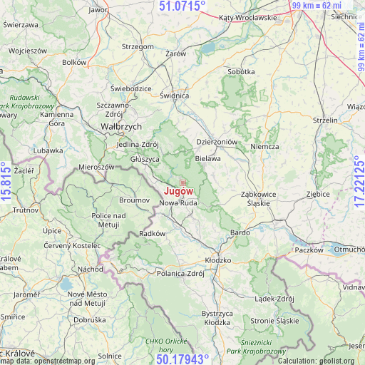
Jugów GPS coordinates[2]
50° 37' 39.288" North, 16° 31' 5.232" East
| Map corner | latitude | longitude |
|---|---|---|
| Upper-left | 51.0715°, | 15.815° |
| Center: | 50.62758°, | 16.51812° |
| Lower-right: | 50.17943°, | 17.22125° |
| Map W x H: | 99.2×99.2 km | = 61.6×61.6mi |
| max Lat: | 54.83135° ⇑64.5% North |
| Jugów: | 50.62758° |
| min Lat: | ⇓35.5% South 49.21328° |
| min Long | Jugów | max Long |
| 14.20249° | 16.51812° | 24.03723° |
| W 10.6%⇐ | ⇒89.4% E |
Elevation
Elevation of Jugów is 472 m = 1549 ft, and this is 280.6 m = 921 ft above average elevation for this country.
| Max E: |
974 m = 3196 ft | 3% |
| Jugów | 472 m 1549 ft | |
| Avg. | 191.4 m = 628 ft | |
Min E: |
-3 m = -10 ft | 97% |
See also: Poland elevation on elevation.city.
Geographical zone
Jugów is located in North temperate zone (between Tropic of Cancer and the Arctic Circle). Distance of this North polar circle is 1771.9 km =1101 mi to North.| Distance of | km | miles | from Jugów |
|---|---|---|---|
| North Pole | 4377.8 | 2720.2 | to North |
| Arctic Circle | 1771.9 | 1101 | to North |
| Tropic Cancer | 3023.3 | 1878.6 | to South |
| Equator | 5629.3 | 3497.9 | to South |


Nearby cities:
15 places around Jugów: (largest is in red/bold)
• Bielawa
10.2 km =6.3 mi,  46°
46°
• Bozkow
13.3 km =8.3 mi,  162°
162°
• Budzów
14.1 km =8.8 mi,  105°
105°
• Dzierżoniów
14.6 km =9.1 mi,  40°
40°
• Głuszyca
12.3 km =7.6 mi,  302°
302°
• Głuszyca Górna
10.9 km =6.8 mi,  293°
293°
• Jedlina-Zdrój
15.9 km =9.9 mi,  310°
310°
• Jodłownik
7 km =4.3 mi,  73°
73°
• Ludwikowice Kłodzkie
4.1 km =2.5 mi,  265°
265°
• Nowa Ruda
5.4 km =3.4 mi,  192°
192°
• Ostroszowice
8.8 km =5.5 mi,  76°
76°
• Pieszyce
10.5 km =6.5 mi,  25°
25°
• Stoszowice
15.9 km =9.9 mi,  101°
101°
• Walim
9.3 km =5.8 mi,  326°
326°
• Włodowice
6.5 km =4 mi,  206°
206°
Sources, notices
• [Note1] Compared only with cities in Poland existing in our database
• [Src1] Map data: © OpenStreetMap contributors (CC-BY-SA)
• [Src2] Other city data from geonames.org with taken over terms of usage.
• [Src3] Geographical zone / Annual Mean Temperature by Robert A. Rohde @ Wikipedia
