Henryków geodata
Henryków (Lower Silesia) is a populated place; located in Poland in Europe/Warsaw (GMT+2) time zone. With population of 3,200 people, there are 991 cities with bigger population in this country. Compared to other cities in Poland, 63.8% of cities are located further ↑North; 84.6% of cities are located further →East and 62.8% of cities have lower elevation than Henryków. Note1


Henryków GPS coordinates[2]
50° 39' 11.772" North, 17° 0' 36.972" East
| Map corner | latitude | longitude |
|---|---|---|
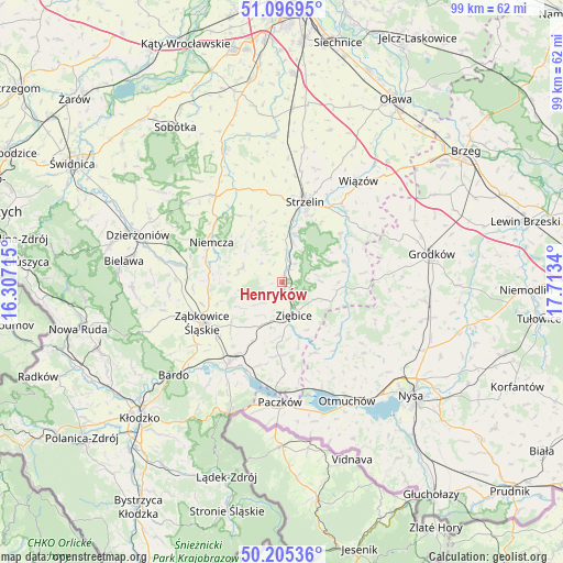
| Upper-left | 51.09695°, | 16.30715° |
| Center: | 50.65327°, | 17.01027° |
| Lower-right: | 50.20536°, | 17.7134° |
| Map W x H: | 99.1×99.1 km | = 61.6×61.6mi |
| max Lat: | 54.83135° ⇑63.8% North |
| Henryków: | 50.65327° |
| min Lat: | ⇓36.2% South 49.21328° |
| min Long | Henryków | max Long |
| 14.20249° | 17.01027° | 24.03723° |
| W 15.4%⇐ | ⇒84.6% E |
Elevation
Elevation of Henryków is 208 m = 682 ft, and this is 16.6 m = 54 ft above average elevation for this country.
| Max E: |
974 m = 3196 ft | 37.2% |
| Henryków | 208 m 682 ft | |
| Avg. | 191.4 m = 628 ft | |
Min E: |
-3 m = -10 ft | 62.8% |
See also: Poland elevation on elevation.city.
Geographical zone
Henryków is located in North temperate zone (between Tropic of Cancer and the Arctic Circle). Distance of this North polar circle is 1769.1 km =1099.3 mi to North.| Distance of | km | miles | from Henryków |
|---|---|---|---|
| North Pole | 4374.9 | 2718.4 | to North |
| Arctic Circle | 1769.1 | 1099.3 | to North |
| Tropic Cancer | 3026.2 | 1880.4 | to South |
| Equator | 5632.1 | 3499.6 | to South |


Nearby cities:
15 places around Henryków: (largest is in red/bold)
• Bobolice
11.2 km =7 mi,  252°
252°
• Ciepłowody
7.5 km =4.7 mi,  288°
288°
• Kamieniec Ząbkowicki
17 km =10.6 mi,  213°
213°
• Kamiennik
13.5 km =8.4 mi,  133°
133°
• Kondratowice
14.4 km =8.9 mi,  338°
338°
• Maciejowice
19.1 km =11.9 mi,  151°
151°
• Niedźwiedź
12.8 km =8 mi,  182°
182°
• Niemcza
14.4 km =8.9 mi,  301°
301°
• Piława Górna
19.1 km =11.9 mi,  280°
280°
• Przeworno
11.6 km =7.2 mi,  71°
71°
• Strzelin
14.8 km =9.2 mi,  15°
15°
• Tarnów
17.6 km =10.9 mi,  241°
241°
• Wilków Wielki
15.9 km =9.9 mi,  314°
314°
• Ziębice
6.2 km =3.9 mi,  159°
159°
• Ząbkowice Śląskie
15.6 km =9.7 mi, 243°
Sources, notices
• [Note1] Compared only with cities in Poland existing in our database
• [Src1] Map data: © OpenStreetMap contributors (CC-BY-SA)
• [Src2] Other city data from geonames.org with taken over terms of usage.
• [Src3] Geographical zone / Annual Mean Temperature by Robert A. Rohde @ Wikipedia
