Gozdowo geodata
Gozdowo (Mazovia) is a seat of a third-order administrative division; located in Poland in Europe/Warsaw (GMT+2) time zone. With population of 1,403 people, there are 1954 cities with bigger population in this country. Compared to other cities in Poland, 79.7% of cities are located further ↓South; 52.5% of cities are located further ←West and 66.1% of cities have higher elevation than Gozdowo. Note1


Gozdowo GPS coordinates[2]
52° 43' 28.38" North, 19° 41' 6.036" East
| Map corner | latitude | longitude |
|---|---|---|
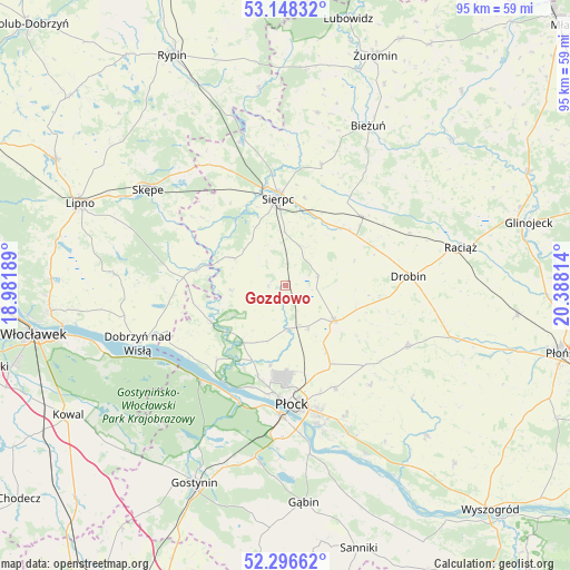
| Upper-left | 53.14832°, | 18.98189° |
| Center: | 52.72455°, | 19.68501° |
| Lower-right: | 52.29662°, | 20.38814° |
| Map W x H: | 94.7×94.7 km | = 58.8×58.8mi |
| max Lat: | 54.83135° ⇑20.3% North |
| Gozdowo: | 52.72455° |
| min Lat: | ⇓79.7% South 49.21328° |
| min Long | Gozdowo | max Long |
| 14.20249° | 19.68501° | 24.03723° |
| W 52.5%⇐ | ⇒47.5% E |
Elevation
Elevation of Gozdowo is 130 m = 427 ft, and this is 61.4 m = 201 ft below average elevation for this country.
| Max E: |
974 m = 3196 ft | 66.1% |
| Avg. | 191.4 m = 628 ft | |
| Gozdowo | 130 m = 427 ft | |
Min E: |
-3 m = -10 ft | 33.9% |
See also: Poland elevation on elevation.city.
Geographical zone
Gozdowo is located in North temperate zone (between Tropic of Cancer and the Arctic Circle). Distance of this North polar circle is 1538.8 km =956.2 mi to North.| Distance of | km | miles | from Gozdowo |
|---|---|---|---|
| North Pole | 4144.6 | 2575.3 | to North |
| Arctic Circle | 1538.8 | 956.2 | to North |
| Tropic Cancer | 3256.5 | 2023.5 | to South |
| Equator | 5862.4 | 3642.7 | to South |


Nearby cities:
15 places around Gozdowo: (largest is in red/bold)
• Biała
13.5 km =8.4 mi,  190°
190°
• Bielsk
10 km =6.2 mi,  125°
125°
• Brudzeń Duży
13.7 km =8.5 mi,  243°
243°
• Drobin
20.5 km =12.7 mi,  85°
85°
• Maszewo Duże
16.5 km =10.3 mi, 193°
• Mochowo
9.8 km =6.1 mi,  297°
297°
• Nowy Duninów
21 km =13 mi,  221°
221°
• Płock
19.8 km =12.3 mi,  175°
175°
• Radzanowo
21.8 km =13.5 mi,  140°
140°
• Rościszewo
20.8 km =12.9 mi,  16°
16°
• Sierpc
14.7 km =9.1 mi,  355°
355°
• Staroźreby
22.7 km =14.1 mi,  116°
116°
• Szczutowo
25.1 km =15.6 mi,  342°
342°
• Tłuchowo
15 km =9.3 mi,  279°
279°
• Zawidz
17.1 km =10.6 mi,  47°
47°
Sources, notices
• [Note1] Compared only with cities in Poland existing in our database
• [Src1] Map data: © OpenStreetMap contributors (CC-BY-SA)
• [Src2] Other city data from geonames.org with taken over terms of usage.
• [Src3] Geographical zone / Annual Mean Temperature by Robert A. Rohde @ Wikipedia
