Drobin geodata
Drobin (Mazovia) is a seat of a third-order administrative division; located in Poland in Europe/Warsaw (GMT+2) time zone. With population of 2,938 people, there are 1075 cities with bigger population in this country. Compared to other cities in Poland, 79.8% of cities are located further ↓South; 58.3% of cities are located further ←West and 66.4% of cities have higher elevation than Drobin. Note1


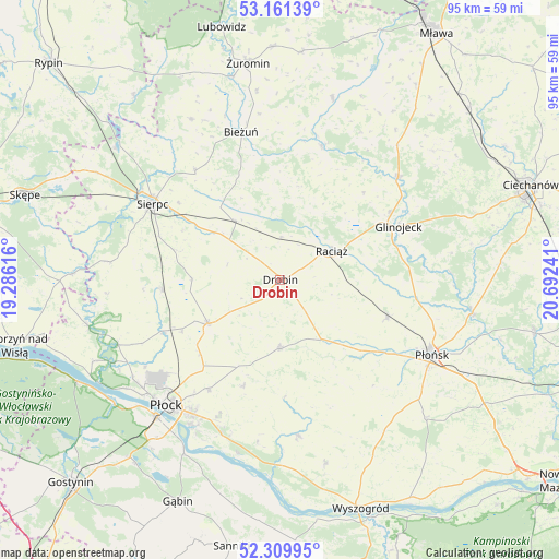
Drobin GPS coordinates[2]
52° 44' 15.9" North, 19° 59' 21.408" East
| Map corner | latitude | longitude |
|---|---|---|
| Upper-left | 53.16139°, | 19.28616° |
| Center: | 52.73775°, | 19.98928° |
| Lower-right: | 52.30995°, | 20.69241° |
| Map W x H: | 94.7×94.7 km | = 58.8×58.8mi |
| max Lat: | 54.83135° ⇑20.2% North |
| Drobin: | 52.73775° |
| min Lat: | ⇓79.8% South 49.21328° |
| min Long | Drobin | max Long |
| 14.20249° | 19.98928° | 24.03723° |
| W 58.3%⇐ | ⇒41.7% E |
Elevation
Elevation of Drobin is 129 m = 423 ft, and this is 62.4 m = 205 ft below average elevation for this country.
| Max E: |
974 m = 3196 ft | 66.4% |
| Avg. | 191.4 m = 628 ft | |
| Drobin | 129 m = 423 ft | |
Min E: |
-3 m = -10 ft | 33.6% |
See also: Poland elevation on elevation.city.
Geographical zone
Drobin is located in North temperate zone (between Tropic of Cancer and the Arctic Circle). Distance of this North polar circle is 1537.3 km =955.2 mi to North.| Distance of | km | miles | from Drobin |
|---|---|---|---|
| North Pole | 4143.2 | 2574.5 | to North |
| Arctic Circle | 1537.3 | 955.2 | to North |
| Tropic Cancer | 3258 | 2024.4 | to South |
| Equator | 5863.9 | 3643.7 | to South |


Nearby cities:
15 places around Drobin: (largest is in red/bold)
• Baboszewo
19 km =11.8 mi,  109°
109°
• Bielsk
14.4 km =8.9 mi,  239°
239°
• Bieżuń
25.7 km =16 mi,  344°
344°
• Bulkowo
23.6 km =14.7 mi,  158°
158°
• Dzierzążnia
20.5 km =12.7 mi,  126°
126°
• Glinojeck
22.3 km =13.9 mi,  65°
65°
• Gozdowo
20.5 km =12.7 mi,  265°
265°
• Raciąż
9.9 km =6.2 mi,  60°
60°
• Radzanowo
19.5 km =12.1 mi,  199°
199°
• Radzanów
23.8 km =14.8 mi,  16°
16°
• Rościszewo
23.4 km =14.5 mi,  321°
321°
• Siemiątkowo
16.2 km =10.1 mi,  9°
9°
• Sierpc
25.3 km =15.7 mi,  301°
301°
• Staroźreby
11.7 km =7.3 mi,  181°
181°
• Zawidz
12.6 km =7.8 mi, 322°
Sources, notices
• [Note1] Compared only with cities in Poland existing in our database
• [Src1] Map data: © OpenStreetMap contributors (CC-BY-SA)
• [Src2] Other city data from geonames.org with taken over terms of usage.
• [Src3] Geographical zone / Annual Mean Temperature by Robert A. Rohde @ Wikipedia
