Gościcino geodata
Gościcino (Pomerania) is a populated place; located in Poland in Europe/Warsaw (GMT+2) time zone. With population of 5,278 people, there are 657 cities with bigger population in this country. Compared to other cities in Poland, 99.2% of cities are located further ↓South; 73.4% of cities are located further →East and 94.5% of cities have higher elevation than Gościcino. Note1


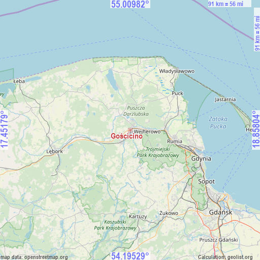
Gościcino GPS coordinates[2]
54° 36' 16.524" North, 18° 9' 17.676" East
| Map corner | latitude | longitude |
|---|---|---|
| Upper-left | 55.00982°, | 17.45179° |
| Center: | 54.60459°, | 18.15491° |
| Lower-right: | 54.19529°, | 18.85804° |
| Map W x H: | 90.6×90.6 km | = 56.3×56.3mi |
| max Lat: | 54.83135° ⇑0.8% North |
| Gościcino: | 54.60459° |
| min Lat: | ⇓99.2% South 49.21328° |
| min Long | Gościcino | max Long |
| 14.20249° | 18.15491° | 24.03723° |
| W 26.6%⇐ | ⇒73.4% E |
Elevation
Elevation of Gościcino is 47 m = 154 ft, and this is 144.4 m = 474 ft below average elevation for this country.
| Max E: |
974 m = 3196 ft | 94.5% |
| Avg. | 191.4 m = 628 ft | |
| Gościcino | 47 m = 154 ft | |
Min E: |
-3 m = -10 ft | 5.5% |
See also: Poland elevation on elevation.city.
Geographical zone
Gościcino is located in North temperate zone (between Tropic of Cancer and the Arctic Circle). Distance of this North polar circle is 1329.7 km =826.2 mi to North.| Distance of | km | miles | from Gościcino |
|---|---|---|---|
| North Pole | 3935.6 | 2445.5 | to North |
| Arctic Circle | 1329.7 | 826.2 | to North |
| Tropic Cancer | 3465.5 | 2153.4 | to South |
| Equator | 6071.5 | 3772.7 | to South |


Nearby cities:
15 places around Gościcino: (largest is in red/bold)
• Bolszewo
2 km =1.2 mi,  42°
42°
• Gniewino
15.3 km =9.5 mi,  324°
324°
• Góra
4 km =2.5 mi, 321°
• Koleczkowo
17.9 km =11.1 mi,  137°
137°
• Luzino
5.2 km =3.2 mi,  214°
214°
• Mrzezino
18.5 km =11.5 mi,  72°
72°
• Orle
4.1 km =2.5 mi,  14°
14°
• Reda
12.4 km =7.7 mi,  89°
89°
• Rekowo Dolne
13.7 km =8.5 mi,  77°
77°
• Rumia
15.5 km =9.6 mi,  103°
103°
• Rybno
9.9 km =6.2 mi,  333°
333°
• Szemud
13.8 km =8.6 mi,  161°
161°
• Wejherowo
5.2 km =3.2 mi, 88°
• Łęczyce
19.1 km =11.9 mi,  266°
266°
• Żelistrzewo
18.7 km =11.6 mi,  64°
64°
Sources, notices
• [Note1] Compared only with cities in Poland existing in our database
• [Src1] Map data: © OpenStreetMap contributors (CC-BY-SA)
• [Src2] Other city data from geonames.org with taken over terms of usage.
• [Src3] Geographical zone / Annual Mean Temperature by Robert A. Rohde @ Wikipedia
