Gomunice geodata
Gomunice (Łódź Voivodeship) is a populated place; located in Poland in Europe/Warsaw (GMT+2) time zone. With population of 1,900 people, there are 1552 cities with bigger population in this country. Compared to other cities in Poland, 50.2% of cities are located further ↓South; 51% of cities are located further →East and 67.7% of cities have lower elevation than Gomunice. Note1
Administrative division(s):
- Level 1: Łódź Voivodeship
- Level 2: Powiat radomszczański
- Level 3: Kamieńsk


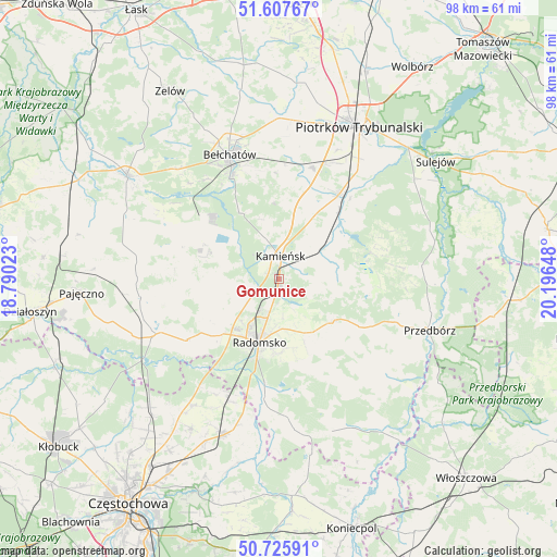
Gomunice GPS coordinates[2]
51° 10' 8.04" North, 19° 29' 36.06" East
| Map corner | latitude | longitude |
|---|---|---|
| Upper-left | 51.60767°, | 18.79023° |
| Center: | 51.1689°, | 19.49335° |
| Lower-right: | 50.72591°, | 20.19648° |
| Map W x H: | 98×98 km | = 60.9×60.9mi |
| max Lat: | 54.83135° ⇑49.8% North |
| Gomunice: | 51.1689° |
| min Lat: | ⇓50.2% South 49.21328° |
| min Long | Gomunice | max Long |
| 14.20249° | 19.49335° | 24.03723° |
| W 49%⇐ | ⇒51% E |
Elevation
Elevation of Gomunice is 222 m = 728 ft, and this is 30.6 m = 100 ft above average elevation for this country.
| Max E: |
974 m = 3196 ft | 32.3% |
| Gomunice | 222 m 728 ft | |
| Avg. | 191.4 m = 628 ft | |
Min E: |
-3 m = -10 ft | 67.7% |
See also: Poland elevation on elevation.city.
Geographical zone
Gomunice is located in North temperate zone (between Tropic of Cancer and the Arctic Circle). Distance of this North polar circle is 1711.7 km =1063.6 mi to North.| Distance of | km | miles | from Gomunice |
|---|---|---|---|
| North Pole | 4317.6 | 2682.8 | to North |
| Arctic Circle | 1711.7 | 1063.6 | to North |
| Tropic Cancer | 3083.5 | 1916 | to South |
| Equator | 5689.4 | 3535.2 | to South |


Nearby cities:
15 places around Gomunice: (largest is in red/bold)
• Dobroszyce
6.3 km =3.9 mi,  244°
244°
• Gorzkowice
8.8 km =5.5 mi,  54°
54°
• Kamieńsk
3.7 km =2.3 mi,  3°
3°
• Kleszczów
14.5 km =9 mi,  294°
294°
• Kobiele Wielkie
17.1 km =10.6 mi,  148°
148°
• Kodrąb
12.2 km =7.6 mi,  129°
129°
• Lgota Wielka
11.8 km =7.3 mi,  259°
259°
• Pławno
21.4 km =13.3 mi,  187°
187°
• Radomsko
11.8 km =7.3 mi,  196°
196°
• Radziechowice Pierwsze
16.2 km =10.1 mi,  226°
226°
• Rozprza
18.3 km =11.4 mi,  35°
35°
• Sulmierzyce
20.8 km =12.9 mi,  274°
274°
• Wola Krzysztoporska
20.4 km =12.7 mi,  17°
17°
• Łęki Szlacheckie
21.3 km =13.2 mi,  84°
84°
• Łękińsko
11.6 km =7.2 mi,  297°
297°
Sources, notices
• [Note1] Compared only with cities in Poland existing in our database
• [Src1] Map data: © OpenStreetMap contributors (CC-BY-SA)
• [Src2] Other city data from geonames.org with taken over terms of usage.
• [Src3] Geographical zone / Annual Mean Temperature by Robert A. Rohde @ Wikipedia
