Łęki Szlacheckie geodata
Łęki Szlacheckie (Łódź Voivodeship) is a seat of a third-order administrative division; located in Poland in Europe/Warsaw (GMT+2) time zone. With population of 450 people, there are 3564 cities with bigger population in this country. Compared to other cities in Poland, 50.5% of cities are located further ↓South; 54.9% of cities are located further ←West and 68.4% of cities have lower elevation than Łęki Szlacheckie. Note1
Administrative division(s):
- Level 1: Łódź Voivodeship
- Level 2: Powiat piotrkowski
- Level 3: Łęki Szlacheckie


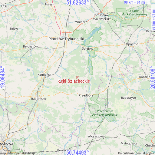
Łęki Szlacheckie GPS coordinates[2]
51° 11' 15.864" North, 19° 47' 52.656" East
| Map corner | latitude | longitude |
|---|---|---|
| Upper-left | 51.62633°, | 19.09484° |
| Center: | 51.18774°, | 19.79796° |
| Lower-right: | 50.74493°, | 20.50109° |
| Map W x H: | 98×98 km | = 60.9×60.9mi |
| max Lat: | 54.83135° ⇑49.5% North |
| Łęki Szlacheckie: | 51.18774° |
| min Lat: | ⇓50.5% South 49.21328° |
| min Long | Łęki Szlachec | max Long |
| 14.20249° | 19.79796° | 24.03723° |
| W 54.9%⇐ | ⇒45.1% E |
Elevation
Elevation of Łęki Szlacheckie is 224 m = 735 ft, and this is 32.6 m = 107 ft above average elevation for this country.
| Max E: |
974 m = 3196 ft | 31.6% |
| Łęki Szlacheckie | 224 m 735 ft | |
| Avg. | 191.4 m = 628 ft | |
Min E: |
-3 m = -10 ft | 68.4% |
See also: Poland elevation on elevation.city.
Geographical zone
Łęki Szlacheckie is located in North temperate zone (between Tropic of Cancer and the Arctic Circle). Distance of this North polar circle is 1709.6 km =1062.3 mi to North.| Distance of | km | miles | from Łęki Szlacheckie |
|---|---|---|---|
| North Pole | 4315.5 | 2681.5 | to North |
| Arctic Circle | 1709.6 | 1062.3 | to North |
| Tropic Cancer | 3085.6 | 1917.3 | to South |
| Equator | 5691.5 | 3536.5 | to South |


Nearby cities:
15 places around Łęki Szlacheckie: (largest is in red/bold)
• Aleksandrów
16.3 km =10.1 mi,  55°
55°
• Czermno
18.2 km =11.3 mi,  118°
118°
• Fałków
22.2 km =13.8 mi,  104°
104°
• Gomunice
21.3 km =13.2 mi,  264°
264°
• Gorzkowice
14.4 km =8.9 mi,  282°
282°
• Kamieńsk
21.1 km =13.1 mi,  274°
274°
• Kobiele Wielkie
20.6 km =12.8 mi,  216°
216°
• Kodrąb
15.3 km =9.5 mi,  230°
230°
• Piotrków Trybunalski
25.1 km =15.6 mi,  344°
344°
• Przedbórz
12.3 km =7.6 mi,  154°
154°
• Rozprza
16.6 km =10.3 mi,  320°
320°
• Ręczno
3.9 km =2.4 mi,  85°
85°
• Sulejów
19.5 km =12.1 mi,  18°
18°
• Wielgomłyny
19.6 km =12.2 mi,  186°
186°
• Wola Krzysztoporska
23 km =14.3 mi, 319°
Sources, notices
• [Note1] Compared only with cities in Poland existing in our database
• [Src1] Map data: © OpenStreetMap contributors (CC-BY-SA)
• [Src2] Other city data from geonames.org with taken over terms of usage.
• [Src3] Geographical zone / Annual Mean Temperature by Robert A. Rohde @ Wikipedia
