Kisielice geodata
Kisielice (Warmia-Masuria) is a seat of a third-order administrative division; located in Poland in Europe/Warsaw (GMT+2) time zone. With population of 2,234 people, there are 1343 cities with bigger population in this country. Compared to other cities in Poland, 90.7% of cities are located further ↓South; 55% of cities are located further →East and 82.7% of cities have higher elevation than Kisielice. Note1


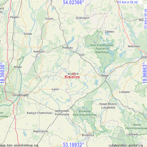
Kisielice GPS coordinates[2]
53° 36' 30.78" North, 19° 15' 48.6" East
| Map corner | latitude | longitude |
|---|---|---|
| Upper-left | 54.02366°, | 18.56038° |
| Center: | 53.60855°, | 19.2635° |
| Lower-right: | 53.18932°, | 19.96663° |
| Map W x H: | 92.8×92.8 km | = 57.7×57.7mi |
| max Lat: | 54.83135° ⇑9.3% North |
| Kisielice: | 53.60855° |
| min Lat: | ⇓90.7% South 49.21328° |
| min Long | Kisielice | max Long |
| 14.20249° | 19.2635° | 24.03723° |
| W 45%⇐ | ⇒55% E |
Elevation
Elevation of Kisielice is 94 m = 308 ft, and this is 97.4 m = 320 ft below average elevation for this country.
| Max E: |
974 m = 3196 ft | 82.7% |
| Avg. | 191.4 m = 628 ft | |
| Kisielice | 94 m = 308 ft | |
Min E: |
-3 m = -10 ft | 17.3% |
See also: Poland elevation on elevation.city.
Geographical zone
Kisielice is located in North temperate zone (between Tropic of Cancer and the Arctic Circle). Distance of this North polar circle is 1440.5 km =895.1 mi to North.| Distance of | km | miles | from Kisielice |
|---|---|---|---|
| North Pole | 4046.3 | 2514.3 | to North |
| Arctic Circle | 1440.5 | 895.1 | to North |
| Tropic Cancer | 3354.8 | 2084.6 | to South |
| Equator | 5960.7 | 3703.8 | to South |


Nearby cities:
15 places around Kisielice: (largest is in red/bold)
• Biskupiec
13.3 km =8.3 mi,  154°
154°
• Gardeja
20.9 km =13 mi,  270°
270°
• Gruta
26.6 km =16.5 mi,  229°
229°
• Iława
20.2 km =12.6 mi,  93°
93°
• Jabłonowo Pomorskie
25.2 km =15.7 mi,  196°
196°
• Kwidzyn
25.4 km =15.8 mi,  300°
300°
• Lipinki
15.8 km =9.8 mi,  167°
167°
• Mikołajki Pomorskie
27.7 km =17.2 mi,  346°
346°
• Ostrowite
21 km =13 mi,  178°
178°
• Prabuty
16.7 km =10.4 mi, 346°
• Rogóźno
23.5 km =14.6 mi,  249°
249°
• Sadlinki
26.8 km =16.7 mi,  283°
283°
• Susz
13 km =8.1 mi,  21°
21°
• Łasin
15.3 km =9.5 mi, 228°
• Świecie nad Osą
21.2 km =13.2 mi,  210°
210°
Sources, notices
• [Note1] Compared only with cities in Poland existing in our database
• [Src1] Map data: © OpenStreetMap contributors (CC-BY-SA)
• [Src2] Other city data from geonames.org with taken over terms of usage.
• [Src3] Geographical zone / Annual Mean Temperature by Robert A. Rohde @ Wikipedia
