Dychów geodata
Dychów (Lubusz) is a populated place; located in Poland in Europe/Warsaw (GMT+2) time zone. With population of 653 people, there are 3158 cities with bigger population in this country. Compared to other cities in Poland, 65.6% of cities are located further ↓South; 97.6% of cities are located further →East and 91.8% of cities have higher elevation than Dychów. Note1


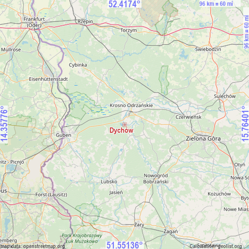
Dychów GPS coordinates[2]
51° 59' 11.292" North, 15° 3' 39.168" East
| Map corner | latitude | longitude |
|---|---|---|
| Upper-left | 52.4174°, | 14.35776° |
| Center: | 51.98647°, | 15.06088° |
| Lower-right: | 51.55136°, | 15.76401° |
| Map W x H: | 96.3×96.3 km | = 59.8×59.8mi |
| max Lat: | 54.83135° ⇑34.4% North |
| Dychów: | 51.98647° |
| min Lat: | ⇓65.6% South 49.21328° |
| min Long | Dychów | max Long |
| 14.20249° | 15.06088° | 24.03723° |
| W 2.4%⇐ | ⇒97.6% E |
Elevation
Elevation of Dychów is 66 m = 217 ft, and this is 125.4 m = 411 ft below average elevation for this country.
| Max E: |
974 m = 3196 ft | 91.8% |
| Avg. | 191.4 m = 628 ft | |
| Dychów | 66 m = 217 ft | |
Min E: |
-3 m = -10 ft | 8.2% |
See also: Poland elevation on elevation.city.
Geographical zone
Dychów is located in North temperate zone (between Tropic of Cancer and the Arctic Circle). Distance of this North polar circle is 1620.8 km =1007.1 mi to North.| Distance of | km | miles | from Dychów |
|---|---|---|---|
| North Pole | 4226.7 | 2626.3 | to North |
| Arctic Circle | 1620.8 | 1007.1 | to North |
| Tropic Cancer | 3174.4 | 1972.5 | to South |
| Equator | 5780.4 | 3591.8 | to South |


Nearby cities:
15 places around Dychów: (largest is in red/bold)
• Bobrowice
4.7 km =2.9 mi,  154°
154°
• Brody
26.9 km =16.7 mi,  71°
71°
• Bytnica
19.7 km =12.2 mi,  22°
22°
• Czerwieńsk
25 km =15.5 mi,  83°
83°
• Dąbie
6.8 km =4.2 mi, 66°
• Gubin
23.1 km =14.4 mi,  259°
259°
• Jasień
26.3 km =16.3 mi,  186°
186°
• Kaczeniec
26.3 km =16.3 mi,  132°
132°
• Krosno Odrzańskie
8 km =5 mi, 18°
• Lubsko
23.3 km =14.5 mi,  195°
195°
• Maszewo
14 km =8.7 mi,  310°
310°
• Nowogród Bobrzański
24.1 km =15 mi, 150°
• Osiecznica
10.1 km =6.3 mi,  355°
355°
• Ploty
24.2 km =15 mi,  90°
90°
• Świdnica
25.1 km =15.6 mi,  115°
115°
Sources, notices
• [Note1] Compared only with cities in Poland existing in our database
• [Src1] Map data: © OpenStreetMap contributors (CC-BY-SA)
• [Src2] Other city data from geonames.org with taken over terms of usage.
• [Src3] Geographical zone / Annual Mean Temperature by Robert A. Rohde @ Wikipedia
