Bierkowice geodata
Bierkowice (Lower Silesia) is a populated place; located in Poland in Europe/Warsaw (GMT+2) time zone. With population of 516 people, there are 3500 cities with bigger population in this country. Compared to other cities in Poland, 67.7% of cities are located further ↑North; 88.8% of cities are located further →East and 87.1% of cities have lower elevation than Bierkowice. Note1


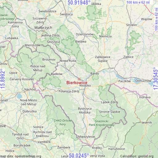
Bierkowice GPS coordinates[2]
50° 28' 26.796" North, 16° 36' 8.352" East
| Map corner | latitude | longitude |
|---|---|---|
| Upper-left | 50.91948°, | 15.8992° |
| Center: | 50.47411°, | 16.60232° |
| Lower-right: | 50.0245°, | 17.30545° |
| Map W x H: | 99.5×99.5 km | = 61.8×61.8mi |
| max Lat: | 54.83135° ⇑67.7% North |
| Bierkowice: | 50.47411° |
| min Lat: | ⇓32.3% South 49.21328° |
| min Long | Bierkowice | max Long |
| 14.20249° | 16.60232° | 24.03723° |
| W 11.2%⇐ | ⇒88.8% E |
Elevation
Elevation of Bierkowice is 301 m = 988 ft, and this is 109.6 m = 360 ft above average elevation for this country.
| Max E: |
974 m = 3196 ft | 12.9% |
| Bierkowice | 301 m 988 ft | |
| Avg. | 191.4 m = 628 ft | |
Min E: |
-3 m = -10 ft | 87.1% |
See also: Poland elevation on elevation.city.
Geographical zone
Bierkowice is located in North temperate zone (between Tropic of Cancer and the Arctic Circle). Distance of this North polar circle is 1789 km =1111.6 mi to North.| Distance of | km | miles | from Bierkowice |
|---|---|---|---|
| North Pole | 4394.9 | 2730.9 | to North |
| Arctic Circle | 1789 | 1111.6 | to North |
| Tropic Cancer | 3006.3 | 1868 | to South |
| Equator | 5612.2 | 3487.3 | to South |


Nearby cities:
15 places around Bierkowice: (largest is in red/bold)
• Bardo
10.4 km =6.5 mi,  70°
70°
• Bozkow
4.7 km =2.9 mi,  336°
336°
• Brzeźnica
11.7 km =7.3 mi,  51°
51°
• Budzów
15.3 km =9.5 mi,  29°
29°
• Duszniki-Zdrój
16.9 km =10.5 mi,  242°
242°
• Kłodzko
6 km =3.7 mi,  136°
136°
• Nowa Ruda
13.8 km =8.6 mi,  328°
328°
• Polanica-Zdrój
10.1 km =6.3 mi,  219°
219°
• Przyłęk
13.4 km =8.3 mi, 68°
• Radków
14.7 km =9.1 mi,  283°
283°
• Stoszowice
17 km =10.6 mi, 34°
• Szczytna
12.9 km =8 mi, 238°
• Tarnów
17.6 km =10.9 mi, 48°
• Wojciechowice
7.6 km =4.7 mi,  106°
106°
• Włodowice
14.4 km =8.9 mi,  321°
321°
Sources, notices
• [Note1] Compared only with cities in Poland existing in our database
• [Src1] Map data: © OpenStreetMap contributors (CC-BY-SA)
• [Src2] Other city data from geonames.org with taken over terms of usage.
• [Src3] Geographical zone / Annual Mean Temperature by Robert A. Rohde @ Wikipedia
