Wilczyce geodata
Wilczyce (Świętokrzyskie) is a seat of a third-order administrative division; located in Poland in Europe/Warsaw (GMT+2) time zone. With population of 830 people, there are 2797 cities with bigger population in this country. Compared to other cities in Poland, 61.5% of cities are located further ↑North; 80.8% of cities are located further ←West and 52.9% of cities have higher elevation than Wilczyce. Note1


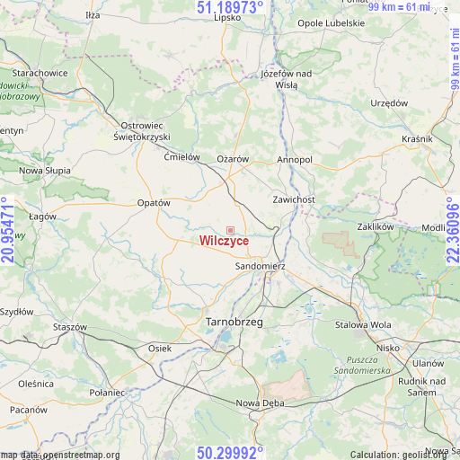
Wilczyce GPS coordinates[2]
50° 44' 48.984" North, 21° 39' 28.188" East
| Map corner | latitude | longitude |
|---|---|---|
| Upper-left | 51.18973°, | 20.95471° |
| Center: | 50.74694°, | 21.65783° |
| Lower-right: | 50.29992°, | 22.36096° |
| Map W x H: | 98.9×98.9 km | = 61.5×61.5mi |
| max Lat: | 54.83135° ⇑61.5% North |
| Wilczyce: | 50.74694° |
| min Lat: | ⇓38.5% South 49.21328° |
| min Long | Wilczyce | max Long |
| 14.20249° | 21.65783° | 24.03723° |
| W 80.8%⇐ | ⇒19.2% E |
Elevation
Elevation of Wilczyce is 164 m = 538 ft, and this is 27.4 m = 90 ft below average elevation for this country.
| Max E: |
974 m = 3196 ft | 52.9% |
| Avg. | 191.4 m = 628 ft | |
| Wilczyce | 164 m = 538 ft | |
Min E: |
-3 m = -10 ft | 47.1% |
See also: Poland elevation on elevation.city.
Geographical zone
Wilczyce is located in North temperate zone (between Tropic of Cancer and the Arctic Circle). Distance of this North polar circle is 1758.6 km =1092.7 mi to North.| Distance of | km | miles | from Wilczyce |
|---|---|---|---|
| North Pole | 4364.5 | 2712 | to North |
| Arctic Circle | 1758.6 | 1092.7 | to North |
| Tropic Cancer | 3036.6 | 1886.9 | to South |
| Equator | 5642.5 | 3506.1 | to South |


Nearby cities:
15 places around Wilczyce: (largest is in red/bold)
• Chwałowice
16.3 km =10.1 mi,  82°
82°
• Dwikozy
9.3 km =5.8 mi,  97°
97°
• Gorzyce
15.6 km =9.7 mi,  124°
124°
• Klimontów
17.5 km =10.9 mi,  234°
234°
• Lipnik
11.7 km =7.3 mi,  260°
260°
• Obrazów
6 km =3.7 mi,  184°
184°
• Opatów
17.4 km =10.8 mi,  290°
290°
• Ożarów
15.7 km =9.8 mi,  2°
2°
• Samborzec
11.2 km =7 mi, 183°
• Sandomierz
9.6 km =6 mi,  138°
138°
• Sobótka
5.6 km =3.5 mi,  13°
13°
• Sokolniki
16 km =9.9 mi, 139°
• Wojciechowice
11.6 km =7.2 mi,  335°
335°
• Zawichost
15.4 km =9.6 mi,  64°
64°
• Złota
9.6 km =6 mi,  169°
169°
Sources, notices
• [Note1] Compared only with cities in Poland existing in our database
• [Src1] Map data: © OpenStreetMap contributors (CC-BY-SA)
• [Src2] Other city data from geonames.org with taken over terms of usage.
• [Src3] Geographical zone / Annual Mean Temperature by Robert A. Rohde @ Wikipedia
