Samborzec geodata
Samborzec (Świętokrzyskie) is a seat of a third-order administrative division; located in Poland in Europe/Warsaw (GMT+2) time zone. With population of 475 people, there are 3551 cities with bigger population in this country. Compared to other cities in Poland, 64% of cities are located further ↑North; 80.6% of cities are located further ←West and 57.6% of cities have higher elevation than Samborzec. Note1


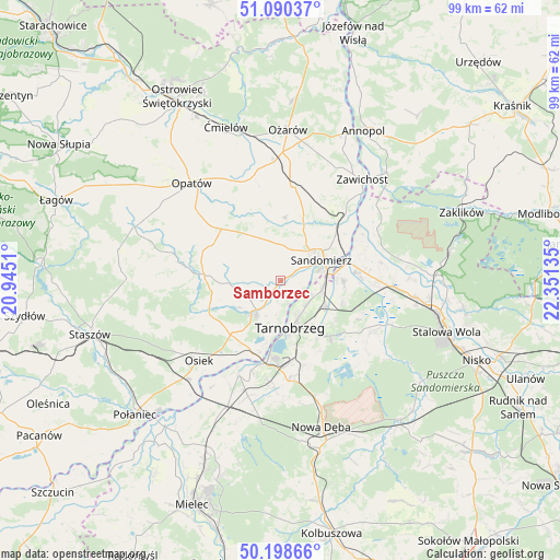
Samborzec GPS coordinates[2]
50° 38' 47.868" North, 21° 38' 53.592" East
| Map corner | latitude | longitude |
|---|---|---|
| Upper-left | 51.09037°, | 20.9451° |
| Center: | 50.64663°, | 21.64822° |
| Lower-right: | 50.19866°, | 22.35135° |
| Map W x H: | 99.1×99.1 km | = 61.6×61.6mi |
| max Lat: | 54.83135° ⇑64% North |
| Samborzec: | 50.64663° |
| min Lat: | ⇓36% South 49.21328° |
| min Long | Samborzec | max Long |
| 14.20249° | 21.64822° | 24.03723° |
| W 80.6%⇐ | ⇒19.4% E |
Elevation
Elevation of Samborzec is 152 m = 499 ft, and this is 39.4 m = 129 ft below average elevation for this country.
| Max E: |
974 m = 3196 ft | 57.6% |
| Avg. | 191.4 m = 628 ft | |
| Samborzec | 152 m = 499 ft | |
Min E: |
-3 m = -10 ft | 42.4% |
See also: Poland elevation on elevation.city.
Geographical zone
Samborzec is located in North temperate zone (between Tropic of Cancer and the Arctic Circle). Distance of this North polar circle is 1769.8 km =1099.7 mi to North.| Distance of | km | miles | from Samborzec |
|---|---|---|---|
| North Pole | 4375.7 | 2718.9 | to North |
| Arctic Circle | 1769.8 | 1099.7 | to North |
| Tropic Cancer | 3025.5 | 1880 | to South |
| Equator | 5631.4 | 3499.2 | to South |


Nearby cities:
15 places around Samborzec: (largest is in red/bold)
• Dwikozy
14 km =8.7 mi,  44°
44°
• Gorzyce
13.7 km =8.5 mi,  80°
80°
• Klimontów
13.6 km =8.5 mi,  274°
274°
• Koprzywnica
7.5 km =4.7 mi,  217°
217°
• Kępie Żaleszańskie
16.5 km =10.3 mi,  92°
92°
• Lipnik
14.3 km =8.9 mi,  310°
310°
• Obrazów
5.1 km =3.2 mi,  1°
1°
• Sandomierz
8.2 km =5.1 mi,  60°
60°
• Sobótka
16.7 km =10.4 mi,  6°
6°
• Sokolniki
11.2 km =7 mi, 94°
• Tarnobrzeg
8.5 km =5.3 mi,  164°
164°
• Wilczyce
11.2 km =7 mi, 3°
• Złota
3 km =1.9 mi, 55°
• Łoniów
12.6 km =7.8 mi, 223°
• Świniary Stare
14.7 km =9.1 mi,  214°
214°
Sources, notices
• [Note1] Compared only with cities in Poland existing in our database
• [Src1] Map data: © OpenStreetMap contributors (CC-BY-SA)
• [Src2] Other city data from geonames.org with taken over terms of usage.
• [Src3] Geographical zone / Annual Mean Temperature by Robert A. Rohde @ Wikipedia
