Szerzyny geodata
Szerzyny (Lesser Poland) is a seat of a third-order administrative division; located in Poland in Europe/Warsaw (GMT+2) time zone. With population of 2,235 people, there are 1342 cities with bigger population in this country. Compared to other cities in Poland, 91.5% of cities are located further ↑North; 76.3% of cities are located further ←West and 80.3% of cities have lower elevation than Szerzyny. Note1


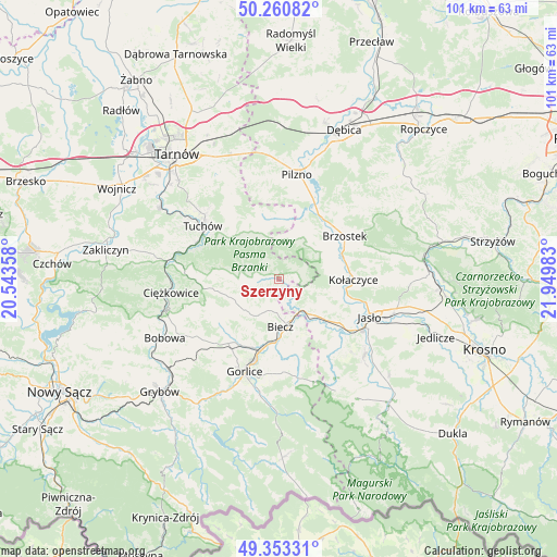
Szerzyny GPS coordinates[2]
49° 48' 33.084" North, 21° 14' 48.12" East
| Map corner | latitude | longitude |
|---|---|---|
| Upper-left | 50.26082°, | 20.54358° |
| Center: | 49.80919°, | 21.2467° |
| Lower-right: | 49.35331°, | 21.94983° |
| Map W x H: | 100.9×100.9 km | = 62.7×62.7mi |
| max Lat: | 54.83135° ⇑91.5% North |
| Szerzyny: | 49.80919° |
| min Lat: | ⇓8.5% South 49.21328° |
| min Long | Szerzyny | max Long |
| 14.20249° | 21.2467° | 24.03723° |
| W 76.3%⇐ | ⇒23.7% E |
Elevation
Elevation of Szerzyny is 267 m = 876 ft, and this is 75.6 m = 248 ft above average elevation for this country.
| Max E: |
974 m = 3196 ft | 19.7% |
| Szerzyny | 267 m 876 ft | |
| Avg. | 191.4 m = 628 ft | |
Min E: |
-3 m = -10 ft | 80.3% |
See also: Poland elevation on elevation.city.
Geographical zone
Szerzyny is located in North temperate zone (between Tropic of Cancer and the Arctic Circle). Distance of this North polar circle is 1862.9 km =1157.6 mi to North.| Distance of | km | miles | from Szerzyny |
|---|---|---|---|
| North Pole | 4468.8 | 2776.8 | to North |
| Arctic Circle | 1862.9 | 1157.6 | to North |
| Tropic Cancer | 2932.3 | 1822 | to South |
| Equator | 5538.3 | 3441.3 | to South |


Nearby cities:
15 places around Szerzyny: (largest is in red/bold)
• Biecz
8.2 km =5.1 mi,  171°
171°
• Binarowa
6 km =3.7 mi,  192°
192°
• Brzyska
10.4 km =6.5 mi,  81°
81°
• Jabłonica
6.1 km =3.8 mi,  106°
106°
• Jodłowa
7.4 km =4.6 mi,  18°
18°
• Korczyna
10.8 km =6.7 mi,  178°
178°
• Kołaczyce
13.4 km =8.3 mi,  90°
90°
• Kwiatonowice
11.5 km =7.1 mi,  211°
211°
• Lipnica Dolna
10.3 km =6.4 mi, 106°
• Ołpiny
3 km =1.9 mi,  265°
265°
• Racławice
7.9 km =4.9 mi, 211°
• Ryglice
11 km =6.8 mi,  314°
314°
• Skołyszyn
9.3 km =5.8 mi,  135°
135°
• Wróblowa
11.2 km =7 mi,  101°
101°
• Żurowa
5.9 km =3.7 mi,  288°
288°
Sources, notices
• [Note1] Compared only with cities in Poland existing in our database
• [Src1] Map data: © OpenStreetMap contributors (CC-BY-SA)
• [Src2] Other city data from geonames.org with taken over terms of usage.
• [Src3] Geographical zone / Annual Mean Temperature by Robert A. Rohde @ Wikipedia
