Przybyszew geodata
Przybyszew (Mazovia) is a populated place; located in Poland in Europe/Warsaw (GMT+2) time zone. With population of 780 people, there are 2898 cities with bigger population in this country. Compared to other cities in Poland, 59.4% of cities are located further ↓South; 70% of cities are located further ←West and 64.1% of cities have higher elevation than Przybyszew. Note1


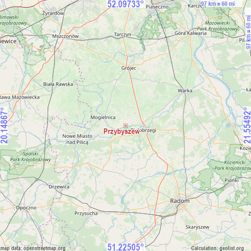
Przybyszew GPS coordinates[2]
51° 39' 47.844" North, 20° 51' 6.444" East
| Map corner | latitude | longitude |
|---|---|---|
| Upper-left | 52.09733°, | 20.14867° |
| Center: | 51.66329°, | 20.85179° |
| Lower-right: | 51.22505°, | 21.55492° |
| Map W x H: | 97×97 km | = 60.3×60.3mi |
| max Lat: | 54.83135° ⇑40.6% North |
| Przybyszew: | 51.66329° |
| min Lat: | ⇓59.4% South 49.21328° |
| min Long | Przybyszew | max Long |
| 14.20249° | 20.85179° | 24.03723° |
| W 70%⇐ | ⇒30% E |
Elevation
Elevation of Przybyszew is 136 m = 446 ft, and this is 55.4 m = 182 ft below average elevation for this country.
| Max E: |
974 m = 3196 ft | 64.1% |
| Avg. | 191.4 m = 628 ft | |
| Przybyszew | 136 m = 446 ft | |
Min E: |
-3 m = -10 ft | 35.9% |
See also: Poland elevation on elevation.city.
Geographical zone
Przybyszew is located in North temperate zone (between Tropic of Cancer and the Arctic Circle). Distance of this North polar circle is 1656.8 km =1029.5 mi to North.| Distance of | km | miles | from Przybyszew |
|---|---|---|---|
| North Pole | 4262.6 | 2648.7 | to North |
| Arctic Circle | 1656.8 | 1029.5 | to North |
| Tropic Cancer | 3138.5 | 1950.2 | to South |
| Equator | 5744.4 | 3569.4 | to South |


Nearby cities:
15 places around Przybyszew: (largest is in red/bold)
• Belsk Duży
18.3 km =11.4 mi,  350°
350°
• Białobrzegi
7 km =4.3 mi,  104°
104°
• Błędów
16.6 km =10.3 mi,  320°
320°
• Goszczyn
7.6 km =4.7 mi,  359°
359°
• Jasieniec
18.6 km =11.6 mi,  19°
19°
• Klwów
20.6 km =12.8 mi,  226°
226°
• Mogielnica
9.6 km =6 mi,  291°
291°
• Nowe Miasto nad Pilicą
19.7 km =12.2 mi,  255°
255°
• Potworów
19.4 km =12.1 mi,  207°
207°
• Promna
7.6 km =4.7 mi,  75°
75°
• Radzanów
11.8 km =7.3 mi,  175°
175°
• Stara Błotnica
15.5 km =9.6 mi,  146°
146°
• Stromiec
16.7 km =10.4 mi, 96°
• Sucha
8.2 km =5.1 mi,  125°
125°
• Wyśmierzyce
5 km =3.1 mi, 211°
Sources, notices
• [Note1] Compared only with cities in Poland existing in our database
• [Src1] Map data: © OpenStreetMap contributors (CC-BY-SA)
• [Src2] Other city data from geonames.org with taken over terms of usage.
• [Src3] Geographical zone / Annual Mean Temperature by Robert A. Rohde @ Wikipedia
