Goszczyn geodata
Goszczyn (Mazovia) is a seat of a third-order administrative division; located in Poland in Europe/Warsaw (GMT+2) time zone. With population of 920 people, there are 2637 cities with bigger population in this country. Compared to other cities in Poland, 60.8% of cities are located further ↓South; 70% of cities are located further ←West and 62.1% of cities have higher elevation than Goszczyn. Note1


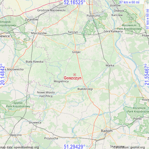
Goszczyn GPS coordinates[2]
51° 43' 54.732" North, 20° 51' 5.544" East
| Map corner | latitude | longitude |
|---|---|---|
| Upper-left | 52.16525°, | 20.14842° |
| Center: | 51.73187°, | 20.85154° |
| Lower-right: | 51.29429°, | 21.55467° |
| Map W x H: | 96.8×96.8 km | = 60.1×60.1mi |
| max Lat: | 54.83135° ⇑39.2% North |
| Goszczyn: | 51.73187° |
| min Lat: | ⇓60.8% South 49.21328° |
| min Long | Goszczyn | max Long |
| 14.20249° | 20.85154° | 24.03723° |
| W 70%⇐ | ⇒30% E |
Elevation
Elevation of Goszczyn is 142 m = 466 ft, and this is 49.4 m = 162 ft below average elevation for this country.
| Max E: |
974 m = 3196 ft | 62.1% |
| Avg. | 191.4 m = 628 ft | |
| Goszczyn | 142 m = 466 ft | |
Min E: |
-3 m = -10 ft | 37.9% |
See also: Poland elevation on elevation.city.
Geographical zone
Goszczyn is located in North temperate zone (between Tropic of Cancer and the Arctic Circle). Distance of this North polar circle is 1649.1 km =1024.7 mi to North.| Distance of | km | miles | from Goszczyn |
|---|---|---|---|
| North Pole | 4255 | 2643.9 | to North |
| Arctic Circle | 1649.1 | 1024.7 | to North |
| Tropic Cancer | 3146.1 | 1954.9 | to South |
| Equator | 5752 | 3574.1 | to South |


Nearby cities:
15 places around Goszczyn: (largest is in red/bold)
• Belsk Duży
10.8 km =6.7 mi,  344°
344°
• Białobrzegi
11.6 km =7.2 mi,  144°
144°
• Błędów
11.7 km =7.3 mi,  295°
295°
• Grójec
14.6 km =9.1 mi,  4°
4°
• Jasieniec
11.7 km =7.3 mi,  31°
31°
• Mogielnica
9.8 km =6.1 mi,  244°
244°
• Nowe Miasto nad Pilicą
22.8 km =14.2 mi, 236°
• Pniewy
21.6 km =13.4 mi, 340°
• Promna
9.4 km =5.8 mi,  127°
127°
• Przybyszew
7.6 km =4.7 mi,  179°
179°
• Radzanów
19.4 km =12.1 mi, 177°
• Stara Błotnica
22.3 km =13.9 mi,  157°
157°
• Stromiec
19.1 km =11.9 mi,  119°
119°
• Sucha
14.1 km =8.8 mi,  151°
151°
• Wyśmierzyce
12.2 km =7.6 mi,  192°
192°
Sources, notices
• [Note1] Compared only with cities in Poland existing in our database
• [Src1] Map data: © OpenStreetMap contributors (CC-BY-SA)
• [Src2] Other city data from geonames.org with taken over terms of usage.
• [Src3] Geographical zone / Annual Mean Temperature by Robert A. Rohde @ Wikipedia
