Niedźwiada geodata
Niedźwiada (Subcarpathian) is a populated place; located in Poland in Europe/Warsaw (GMT+2) time zone. With population of 2,466 people, there are 1262 cities with bigger population in this country. Compared to other cities in Poland, 83% of cities are located further ↑North; 79.3% of cities are located further ←West and 73.8% of cities have lower elevation than Niedźwiada. Note1
Administrative division(s):
- Level 1: Subcarpathian
- Level 2: Powiat ropczycko-sędziszowski
- Level 3: Ropczyce


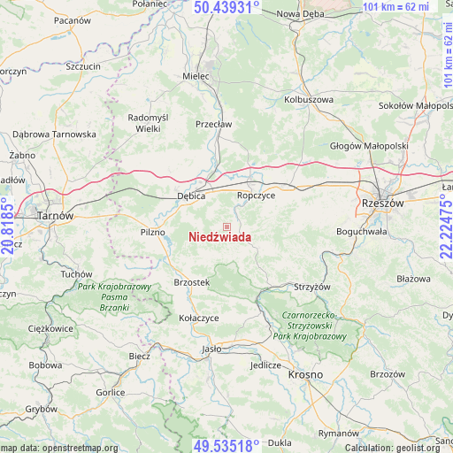
Niedźwiada GPS coordinates[2]
49° 59' 21.732" North, 21° 31' 17.832" East
| Map corner | latitude | longitude |
|---|---|---|
| Upper-left | 50.43931°, | 20.8185° |
| Center: | 49.98937°, | 21.52162° |
| Lower-right: | 49.53518°, | 22.22475° |
| Map W x H: | 100.5×100.5 km | = 62.4×62.4mi |
| max Lat: | 54.83135° ⇑83% North |
| Niedźwiada: | 49.98937° |
| min Lat: | ⇓17% South 49.21328° |
| min Long | Niedźwiada | max Long |
| 14.20249° | 21.52162° | 24.03723° |
| W 79.3%⇐ | ⇒20.7% E |
Elevation
Elevation of Niedźwiada is 242 m = 794 ft, and this is 50.6 m = 166 ft above average elevation for this country.
| Max E: |
974 m = 3196 ft | 26.2% |
| Niedźwiada | 242 m 794 ft | |
| Avg. | 191.4 m = 628 ft | |
Min E: |
-3 m = -10 ft | 73.8% |
See also: Poland elevation on elevation.city.
Geographical zone
Niedźwiada is located in North temperate zone (between Tropic of Cancer and the Arctic Circle). Distance of this North polar circle is 1842.9 km =1145.1 mi to North.| Distance of | km | miles | from Niedźwiada |
|---|---|---|---|
| North Pole | 4448.8 | 2764.4 | to North |
| Arctic Circle | 1842.9 | 1145.1 | to North |
| Tropic Cancer | 2952.4 | 1834.5 | to South |
| Equator | 5558.3 | 3453.8 | to South |


Nearby cities:
15 places around Niedźwiada: (largest is in red/bold)
• Brzeźnica
12.7 km =7.9 mi,  346°
346°
• Brzostek
14.6 km =9.1 mi,  212°
212°
• Bystrzyca
14.9 km =9.3 mi,  94°
94°
• Dębica
10.5 km =6.5 mi,  311°
311°
• Ostrów
13.1 km =8.1 mi,  22°
22°
• Pilzno
16.4 km =10.2 mi,  265°
265°
• Przyborów
13.6 km =8.5 mi,  288°
288°
• Ropczyce
9.4 km =5.8 mi,  41°
41°
• Strzegocice
14.9 km =9.3 mi,  253°
253°
• Sędziszów Małopolski
15.7 km =9.8 mi,  54°
54°
• Wielopole Skrzyńskie
8.3 km =5.2 mi,  126°
126°
• Wiśniowa
16.4 km =10.2 mi,  144°
144°
• Wiśniowa
16.7 km =10.4 mi, 86°
• Zagórzyce
11.4 km =7.1 mi,  74°
74°
• Żyraków
13.9 km =8.6 mi,  320°
320°
Sources, notices
• [Note1] Compared only with cities in Poland existing in our database
• [Src1] Map data: © OpenStreetMap contributors (CC-BY-SA)
• [Src2] Other city data from geonames.org with taken over terms of usage.
• [Src3] Geographical zone / Annual Mean Temperature by Robert A. Rohde @ Wikipedia
