Bystrzyca geodata
Bystrzyca (Subcarpathian) is a populated place; located in Poland in Europe/Warsaw (GMT+2) time zone. With population of 944 people, there are 2603 cities with bigger population in this country. Compared to other cities in Poland, 84.1% of cities are located further ↑North; 81.4% of cities are located further ←West and 87.5% of cities have lower elevation than Bystrzyca. Note1
Administrative division(s):
- Level 1: Subcarpathian
- Level 2: Powiat ropczycko-sędziszowski
- Level 3: Iwierzyce


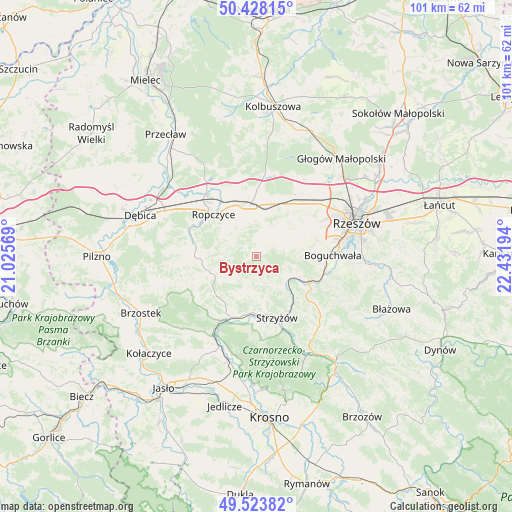
Bystrzyca GPS coordinates[2]
49° 58' 41.196" North, 21° 43' 43.716" East
| Map corner | latitude | longitude |
|---|---|---|
| Upper-left | 50.42815°, | 21.02569° |
| Center: | 49.97811°, | 21.72881° |
| Lower-right: | 49.52382°, | 22.43194° |
| Map W x H: | 100.6×100.6 km | = 62.5×62.5mi |
| max Lat: | 54.83135° ⇑84.1% North |
| Bystrzyca: | 49.97811° |
| min Lat: | ⇓15.9% South 49.21328° |
| min Long | Bystrzyca | max Long |
| 14.20249° | 21.72881° | 24.03723° |
| W 81.4%⇐ | ⇒18.6% E |
Elevation
Elevation of Bystrzyca is 305 m = 1001 ft, and this is 113.6 m = 373 ft above average elevation for this country.
| Max E: |
974 m = 3196 ft | 12.5% |
| Bystrzyca | 305 m 1001 ft | |
| Avg. | 191.4 m = 628 ft | |
Min E: |
-3 m = -10 ft | 87.5% |
See also: Poland elevation on elevation.city.
Geographical zone
Bystrzyca is located in North temperate zone (between Tropic of Cancer and the Arctic Circle). Distance of this North polar circle is 1844.1 km =1145.9 mi to North.| Distance of | km | miles | from Bystrzyca |
|---|---|---|---|
| North Pole | 4450 | 2765.1 | to North |
| Arctic Circle | 1844.1 | 1145.9 | to North |
| Tropic Cancer | 2951.1 | 1833.7 | to South |
| Equator | 5557 | 3453 | to South |


Nearby cities:
15 places around Bystrzyca: (largest is in red/bold)
• Babica
11.2 km =7 mi,  115°
115°
• Czudec
8.9 km =5.5 mi,  114°
114°
• Iwierzyce
6 km =3.7 mi,  17°
17°
• Krzywa
13.6 km =8.5 mi,  1°
1°
• Lutoryż
13.2 km =8.2 mi,  95°
95°
• Niechobrz
10.8 km =6.7 mi,  80°
80°
• Ropczyce
11.9 km =7.4 mi,  313°
313°
• Strzyżów
12.8 km =8 mi,  158°
158°
• Sędziszów Małopolski
10.5 km =6.5 mi,  348°
348°
• Trzciana
13 km =8.1 mi,  36°
36°
• Wielopole Skrzyńskie
8.9 km =5.5 mi,  246°
246°
• Wiśniowa
2.9 km =1.8 mi, 39°
• Wiśniowa
13.2 km =8.2 mi,  203°
203°
• Zagórzyce
5.8 km =3.6 mi,  318°
318°
• Zgłobień
9.8 km =6.1 mi,  66°
66°
Sources, notices
• [Note1] Compared only with cities in Poland existing in our database
• [Src1] Map data: © OpenStreetMap contributors (CC-BY-SA)
• [Src2] Other city data from geonames.org with taken over terms of usage.
• [Src3] Geographical zone / Annual Mean Temperature by Robert A. Rohde @ Wikipedia
