Korytnica geodata
Korytnica (Świętokrzyskie) is a populated place; located in Poland in Europe/Warsaw (GMT+2) time zone. With population of 860 people, there are 2749 cities with bigger population in this country. Compared to other cities in Poland, 63.7% of cities are located further ↑North; 65.2% of cities are located further ←West and 67.1% of cities have lower elevation than Korytnica. Note1


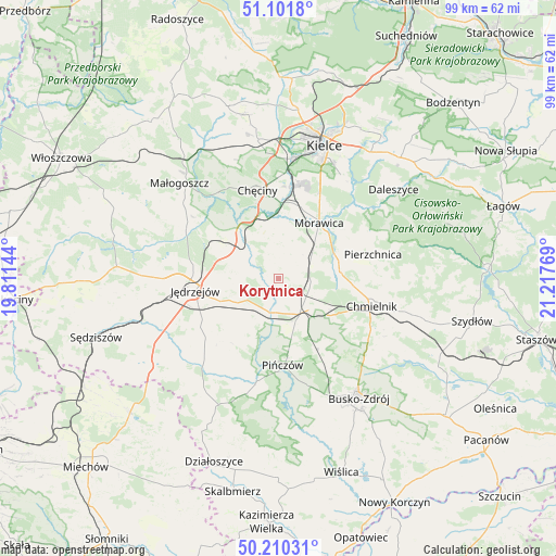
Korytnica GPS coordinates[2]
50° 39' 29.412" North, 20° 30' 52.416" East
| Map corner | latitude | longitude |
|---|---|---|
| Upper-left | 51.1018°, | 19.81144° |
| Center: | 50.65817°, | 20.51456° |
| Lower-right: | 50.21031°, | 21.21769° |
| Map W x H: | 99.1×99.1 km | = 61.6×61.6mi |
| max Lat: | 54.83135° ⇑63.7% North |
| Korytnica: | 50.65817° |
| min Lat: | ⇓36.3% South 49.21328° |
| min Long | Korytnica | max Long |
| 14.20249° | 20.51456° | 24.03723° |
| W 65.2%⇐ | ⇒34.8% E |
Elevation
Elevation of Korytnica is 220 m = 722 ft, and this is 28.6 m = 94 ft above average elevation for this country.
| Max E: |
974 m = 3196 ft | 32.9% |
| Korytnica | 220 m 722 ft | |
| Avg. | 191.4 m = 628 ft | |
Min E: |
-3 m = -10 ft | 67.1% |
See also: Poland elevation on elevation.city.
Geographical zone
Korytnica is located in North temperate zone (between Tropic of Cancer and the Arctic Circle). Distance of this North polar circle is 1768.5 km =1098.9 mi to North.| Distance of | km | miles | from Korytnica |
|---|---|---|---|
| North Pole | 4374.4 | 2718.1 | to North |
| Arctic Circle | 1768.5 | 1098.9 | to North |
| Tropic Cancer | 3026.7 | 1880.7 | to South |
| Equator | 5632.7 | 3500 | to South |


Nearby cities:
15 places around Korytnica: (largest is in red/bold)
• Brzeziny
13.4 km =8.3 mi,  17°
17°
• Chmielnik
17.4 km =10.8 mi,  106°
106°
• Chęciny
16.2 km =10.1 mi,  346°
346°
• Imielno
9.3 km =5.8 mi,  210°
210°
• Jędrzejów
15 km =9.3 mi,  261°
261°
• Kije
6.9 km =4.3 mi,  144°
144°
• Michałów
18.5 km =11.5 mi,  191°
191°
• Morawica
12.2 km =7.6 mi,  36°
36°
• Osiedle-Nowiny
17.8 km =11.1 mi,  6°
6°
• Pierzchnica
17.5 km =10.9 mi,  75°
75°
• Pińczów
15.3 km =9.5 mi,  176°
176°
• Potok Wielki
21.3 km =13.2 mi,  252°
252°
• Siedlce
9.6 km =6 mi, 350°
• Sobków
6.5 km =4 mi,  315°
315°
• Łukowa
7.6 km =4.7 mi, 12°
Sources, notices
• [Note1] Compared only with cities in Poland existing in our database
• [Src1] Map data: © OpenStreetMap contributors (CC-BY-SA)
• [Src2] Other city data from geonames.org with taken over terms of usage.
• [Src3] Geographical zone / Annual Mean Temperature by Robert A. Rohde @ Wikipedia
