Jedwabno geodata
Jedwabno (Warmia-Masuria) is a populated place; located in Poland in Europe/Warsaw (GMT+2) time zone. With population of 1,125 people, there are 2274 cities with bigger population in this country. Compared to other cities in Poland, 89.9% of cities are located further ↓South; 68.2% of cities are located further ←West and 63% of cities have higher elevation than Jedwabno. Note1


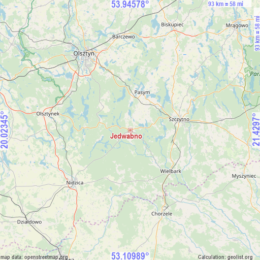
Jedwabno GPS coordinates[2]
53° 31' 47.64" North, 20° 43' 35.652" East
| Map corner | latitude | longitude |
|---|---|---|
| Upper-left | 53.94578°, | 20.02345° |
| Center: | 53.5299°, | 20.72657° |
| Lower-right: | 53.10989°, | 21.4297° |
| Map W x H: | 92.9×92.9 km | = 57.7×57.7mi |
| max Lat: | 54.83135° ⇑10.1% North |
| Jedwabno: | 53.5299° |
| min Lat: | ⇓89.9% South 49.21328° |
| min Long | Jedwabno | max Long |
| 14.20249° | 20.72657° | 24.03723° |
| W 68.2%⇐ | ⇒31.8% E |
Elevation
Elevation of Jedwabno is 139 m = 456 ft, and this is 52.4 m = 172 ft below average elevation for this country.
| Max E: |
974 m = 3196 ft | 63% |
| Avg. | 191.4 m = 628 ft | |
| Jedwabno | 139 m = 456 ft | |
Min E: |
-3 m = -10 ft | 37% |
See also: Poland elevation on elevation.city.
Geographical zone
Jedwabno is located in North temperate zone (between Tropic of Cancer and the Arctic Circle). Distance of this North polar circle is 1449.2 km =900.5 mi to North.| Distance of | km | miles | from Jedwabno |
|---|---|---|---|
| North Pole | 4055.1 | 2519.7 | to North |
| Arctic Circle | 1449.2 | 900.5 | to North |
| Tropic Cancer | 3346 | 2079.1 | to South |
| Equator | 5952 | 3698.4 | to South |


Nearby cities:
15 places around Jedwabno: (largest is in red/bold)
• Barczewo
33.5 km =20.8 mi,  356°
356°
• Chorzele
32 km =19.9 mi,  159°
159°
• Dźwierzuty
24.8 km =15.4 mi,  38°
38°
• Jabłonka
11.7 km =7.3 mi,  251°
251°
• Janowo
24.1 km =15 mi,  188°
188°
• Kortowo
30.9 km =19.2 mi,  324°
324°
• Nidzica
27.3 km =17 mi,  226°
226°
• Olsztyn
31.7 km =19.7 mi,  331°
331°
• Olsztynek
29.8 km =18.5 mi,  281°
281°
• Pasym
14.1 km =8.8 mi,  17°
17°
• Purda
19.9 km =12.4 mi, 356°
• Stawiguda
25.8 km =16 mi,  303°
303°
• Szczytno
17.6 km =10.9 mi,  78°
78°
• Wielbark
20.6 km =12.8 mi,  135°
135°
• Świętajno
32.6 km =20.3 mi, 82°
Sources, notices
• [Note1] Compared only with cities in Poland existing in our database
• [Src1] Map data: © OpenStreetMap contributors (CC-BY-SA)
• [Src2] Other city data from geonames.org with taken over terms of usage.
• [Src3] Geographical zone / Annual Mean Temperature by Robert A. Rohde @ Wikipedia
