Chorzele geodata
Chorzele (Mazovia) is a seat of a third-order administrative division; located in Poland in Europe/Warsaw (GMT+2) time zone. With population of 2,807 people, there are 1115 cities with bigger population in this country. Compared to other cities in Poland, 87% of cities are located further ↓South; 70.7% of cities are located further ←West and 68.6% of cities have higher elevation than Chorzele. Note1


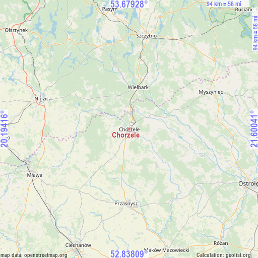
Chorzele GPS coordinates[2]
53° 15' 38.7" North, 20° 53' 50.208" East
| Map corner | latitude | longitude |
|---|---|---|
| Upper-left | 53.67928°, | 20.19416° |
| Center: | 53.26075°, | 20.89728° |
| Lower-right: | 52.83809°, | 21.60041° |
| Map W x H: | 93.5×93.5 km | = 58.1×58.1mi |
| max Lat: | 54.83135° ⇑13% North |
| Chorzele: | 53.26075° |
| min Lat: | ⇓87% South 49.21328° |
| min Long | Chorzele | max Long |
| 14.20249° | 20.89728° | 24.03723° |
| W 70.7%⇐ | ⇒29.3% E |
Elevation
Elevation of Chorzele is 124 m = 407 ft, and this is 67.4 m = 221 ft below average elevation for this country.
| Max E: |
974 m = 3196 ft | 68.6% |
| Avg. | 191.4 m = 628 ft | |
| Chorzele | 124 m = 407 ft | |
Min E: |
-3 m = -10 ft | 31.4% |
See also: Poland elevation on elevation.city.
Geographical zone
Chorzele is located in North temperate zone (between Tropic of Cancer and the Arctic Circle). Distance of this North polar circle is 1479.1 km =919.1 mi to North.| Distance of | km | miles | from Chorzele |
|---|---|---|---|
| North Pole | 4085 | 2538.3 | to North |
| Arctic Circle | 1479.1 | 919.1 | to North |
| Tropic Cancer | 3316.1 | 2060.5 | to South |
| Equator | 5922 | 3679.8 | to South |


Nearby cities:
15 places around Chorzele: (largest is in red/bold)
• Baranowo
28.3 km =17.6 mi,  109°
109°
• Czarnia
22.5 km =14 mi,  61°
61°
• Czernice Borowe
28.1 km =17.5 mi,  204°
204°
• Dzierzgowo
19.7 km =12.2 mi,  232°
232°
• Grudusk
28.9 km =18 mi,  218°
218°
• Janowo
16.2 km =10.1 mi,  292°
292°
• Jednorożec
16.8 km =10.4 mi,  142°
142°
• Jedwabno
32 km =19.9 mi,  339°
339°
• Krasnosielc
30.6 km =19 mi,  145°
145°
• Krzynowłoga Mała
13.7 km =8.5 mi,  212°
212°
• Myszyniec
32.9 km =20.4 mi,  66°
66°
• Nidzica
33.1 km =20.6 mi, 289°
• Przasnysz
26.9 km =16.7 mi,  182°
182°
• Wieczfnia Kościelna
28.9 km =18 mi,  255°
255°
• Wielbark
15.7 km =9.8 mi,  11°
11°
Sources, notices
• [Note1] Compared only with cities in Poland existing in our database
• [Src1] Map data: © OpenStreetMap contributors (CC-BY-SA)
• [Src2] Other city data from geonames.org with taken over terms of usage.
• [Src3] Geographical zone / Annual Mean Temperature by Robert A. Rohde @ Wikipedia
