Gąsocin geodata
Gąsocin (Mazovia) is a populated place; located in Poland in Europe/Warsaw (GMT+2) time zone. With population of 1,238 people, there are 2139 cities with bigger population in this country. Compared to other cities in Poland, 79.8% of cities are located further ↓South; 67.8% of cities are located further ←West and 72.6% of cities have higher elevation than Gąsocin. Note1


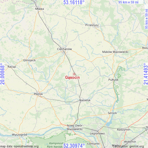
Gąsocin GPS coordinates[2]
52° 44' 15.144" North, 20° 42' 42.48" East
| Map corner | latitude | longitude |
|---|---|---|
| Upper-left | 53.16118°, | 20.00868° |
| Center: | 52.73754°, | 20.7118° |
| Lower-right: | 52.30974°, | 21.41493° |
| Map W x H: | 94.7×94.7 km | = 58.8×58.8mi |
| max Lat: | 54.83135° ⇑20.2% North |
| Gąsocin: | 52.73754° |
| min Lat: | ⇓79.8% South 49.21328° |
| min Long | Gąsocin | max Long |
| 14.20249° | 20.7118° | 24.03723° |
| W 67.8%⇐ | ⇒32.2% E |
Elevation
Elevation of Gąsocin is 116 m = 381 ft, and this is 75.4 m = 247 ft below average elevation for this country.
| Max E: |
974 m = 3196 ft | 72.6% |
| Avg. | 191.4 m = 628 ft | |
| Gąsocin | 116 m = 381 ft | |
Min E: |
-3 m = -10 ft | 27.4% |
See also: Poland elevation on elevation.city.
Geographical zone
Gąsocin is located in North temperate zone (between Tropic of Cancer and the Arctic Circle). Distance of this North polar circle is 1537.3 km =955.2 mi to North.| Distance of | km | miles | from Gąsocin |
|---|---|---|---|
| North Pole | 4143.2 | 2574.5 | to North |
| Arctic Circle | 1537.3 | 955.2 | to North |
| Tropic Cancer | 3257.9 | 2024.4 | to South |
| Equator | 5863.9 | 3643.7 | to South |


Nearby cities:
15 places around Gąsocin: (largest is in red/bold)
• Ciechanów
17.1 km =10.6 mi,  338°
338°
• Gołotczyzna
5.9 km =3.7 mi,  346°
346°
• Gołymin-Ośrodek
13.4 km =8.3 mi,  54°
54°
• Gzy
15.6 km =9.7 mi,  88°
88°
• Joniec
17.5 km =10.9 mi,  210°
210°
• Karniewo
21.7 km =13.5 mi,  59°
59°
• Nasielsk
17.7 km =11 mi,  159°
159°
• Nowe Miasto
10.6 km =6.6 mi, 212°
• Ojrzeń
11.8 km =7.3 mi,  285°
285°
• Opinogóra Górna
18.7 km =11.6 mi,  1°
1°
• Pokrzywnica
24.5 km =15.2 mi,  122°
122°
• Sochocin
17.1 km =10.6 mi,  250°
250°
• Sońsk
5 km =3.1 mi, 350°
• Winnica
18.7 km =11.6 mi, 124°
• Świercze
8.2 km =5.1 mi,  154°
154°
Sources, notices
• [Note1] Compared only with cities in Poland existing in our database
• [Src1] Map data: © OpenStreetMap contributors (CC-BY-SA)
• [Src2] Other city data from geonames.org with taken over terms of usage.
• [Src3] Geographical zone / Annual Mean Temperature by Robert A. Rohde @ Wikipedia
