Czersk geodata
Czersk (Mazovia) is a populated place; located in Poland in Europe/Warsaw (GMT+2) time zone. With population of 590 people, there are 3306 cities with bigger population in this country. Compared to other cities in Poland, 64.8% of cities are located further ↓South; 76.1% of cities are located further ←West and 75% of cities have higher elevation than Czersk. Note1


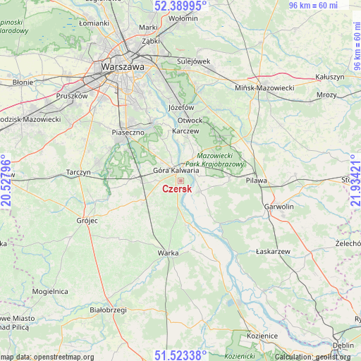
Czersk GPS coordinates[2]
51° 57' 31.536" North, 21° 13' 51.888" East
| Map corner | latitude | longitude |
|---|---|---|
| Upper-left | 52.38995°, | 20.52796° |
| Center: | 51.95876°, | 21.23108° |
| Lower-right: | 51.52338°, | 21.93421° |
| Map W x H: | 96.4×96.4 km | = 59.9×59.9mi |
| max Lat: | 54.83135° ⇑35.2% North |
| Czersk: | 51.95876° |
| min Lat: | ⇓64.8% South 49.21328° |
| min Long | Czersk | max Long |
| 14.20249° | 21.23108° | 24.03723° |
| W 76.1%⇐ | ⇒23.9% E |
Elevation
Elevation of Czersk is 111 m = 364 ft, and this is 80.4 m = 264 ft below average elevation for this country.
| Max E: |
974 m = 3196 ft | 75% |
| Avg. | 191.4 m = 628 ft | |
| Czersk | 111 m = 364 ft | |
Min E: |
-3 m = -10 ft | 25% |
See also: Poland elevation on elevation.city.
Geographical zone
Czersk is located in North temperate zone (between Tropic of Cancer and the Arctic Circle). Distance of this North polar circle is 1623.9 km =1009 mi to North.| Distance of | km | miles | from Czersk |
|---|---|---|---|
| North Pole | 4229.8 | 2628.3 | to North |
| Arctic Circle | 1623.9 | 1009 | to North |
| Tropic Cancer | 3171.4 | 1970.6 | to South |
| Equator | 5777.3 | 3589.8 | to South |


Nearby cities:
15 places around Czersk: (largest is in red/bold)
• Baniocha
9 km =5.6 mi,  315°
315°
• Celestynów
15.8 km =9.8 mi,  43°
43°
• Chylice
17.6 km =10.9 mi, 319°
• Chynów
11.9 km =7.4 mi,  239°
239°
• Czarnów
14.2 km =8.8 mi, 319°
• Góra Kalwaria
2.2 km =1.4 mi,  331°
331°
• Karczew
13.2 km =8.2 mi,  5°
5°
• Konstancin-Jeziorna
16.9 km =10.5 mi, 332°
• Osieck
12.9 km =8 mi,  86°
86°
• Otwock
16.5 km =10.3 mi, 7°
• Sobienie Jeziory
5.7 km =3.5 mi,  120°
120°
• Sułkowice
10.5 km =6.5 mi,  247°
247°
• Wilga
15.5 km =9.6 mi,  139°
139°
• Zalesie Górne
15.4 km =9.6 mi,  299°
299°
• Żabieniec
16.7 km =10.4 mi,  311°
311°
Sources, notices
• [Note1] Compared only with cities in Poland existing in our database
• [Src1] Map data: © OpenStreetMap contributors (CC-BY-SA)
• [Src2] Other city data from geonames.org with taken over terms of usage.
• [Src3] Geographical zone / Annual Mean Temperature by Robert A. Rohde @ Wikipedia
