Ciechanowiec geodata
Ciechanowiec (Podlasie) is a populated place; located in Poland in Europe/Warsaw (GMT+2) time zone. With population of 4,946 people, there are 694 cities with bigger population in this country. Compared to other cities in Poland, 79% of cities are located further ↓South; 91.6% of cities are located further ←West and 72.6% of cities have higher elevation than Ciechanowiec. Note1
Administrative division(s):
- Level 1: Podlasie
- Level 2: Powiat wysokomazowiecki
- Level 3: Ciechanowiec


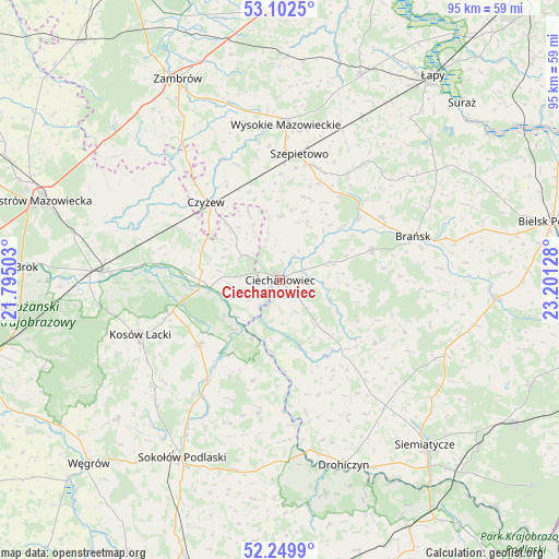
Ciechanowiec GPS coordinates[2]
52° 40' 41.808" North, 22° 29' 53.34" East
| Map corner | latitude | longitude |
|---|---|---|
| Upper-left | 53.1025°, | 21.79503° |
| Center: | 52.67828°, | 22.49815° |
| Lower-right: | 52.2499°, | 23.20128° |
| Map W x H: | 94.8×94.8 km | = 58.9×58.9mi |
| max Lat: | 54.83135° ⇑21% North |
| Ciechanowiec: | 52.67828° |
| min Lat: | ⇓79% South 49.21328° |
| min Long | Ciechanowiec | max Long |
| 14.20249° | 22.49815° | 24.03723° |
| W 91.6%⇐ | ⇒8.4% E |
Elevation
Elevation of Ciechanowiec is 116 m = 381 ft, and this is 75.4 m = 247 ft below average elevation for this country.
| Max E: |
974 m = 3196 ft | 72.6% |
| Avg. | 191.4 m = 628 ft | |
| Ciechanowiec | 116 m = 381 ft | |
Min E: |
-3 m = -10 ft | 27.4% |
See also: Poland elevation on elevation.city.
Geographical zone
Ciechanowiec is located in North temperate zone (between Tropic of Cancer and the Arctic Circle). Distance of this North polar circle is 1543.9 km =959.3 mi to North.| Distance of | km | miles | from Ciechanowiec |
|---|---|---|---|
| North Pole | 4149.8 | 2578.6 | to North |
| Arctic Circle | 1543.9 | 959.3 | to North |
| Tropic Cancer | 3251.4 | 2020.3 | to South |
| Equator | 5857.3 | 3639.6 | to South |


Nearby cities:
15 places around Ciechanowiec: (largest is in red/bold)
• Andrzejewo
26.1 km =16.2 mi,  310°
310°
• Boguty-Pianki
7 km =4.3 mi, 307°
• Brańsk
24 km =14.9 mi,  72°
72°
• Ceranów
19 km =11.8 mi,  253°
253°
• Czyżew
18.2 km =11.3 mi,  316°
316°
• Grodzisk
19.3 km =12 mi,  122°
122°
• Jabłonna Lacka
22.7 km =14.1 mi,  189°
189°
• Klukowo
11 km =6.8 mi,  3°
3°
• Kosów Lacki
25.4 km =15.8 mi, 248°
• Nur
11.9 km =7.4 mi,  264°
264°
• Perlejewo
13.2 km =8.2 mi,  160°
160°
• Rudka
16.2 km =10.1 mi, 71°
• Sabnie
23.6 km =14.7 mi,  213°
213°
• Sterdyń
17.6 km =10.9 mi,  231°
231°
• Szepietowo
21.6 km =13.4 mi,  8°
8°
Sources, notices
• [Note1] Compared only with cities in Poland existing in our database
• [Src1] Map data: © OpenStreetMap contributors (CC-BY-SA)
• [Src2] Other city data from geonames.org with taken over terms of usage.
• [Src3] Geographical zone / Annual Mean Temperature by Robert A. Rohde @ Wikipedia
